ArcGIS API for js Legend(图例)
1、说明
有关怎么把ArcGIS API for js部署到IIS上,请参考我上面的写的博客https://www.cnblogs.com/net064/p/10302660.html
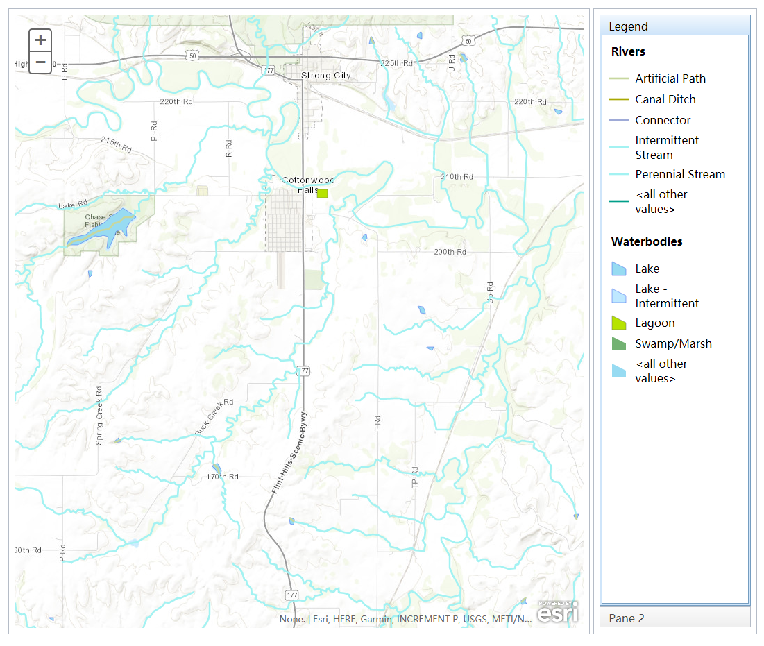
2、运行效果
3、html代码
<!DOCTYPE html>

<html>

<head>

  <meta http-equiv="Content-Type" content="text/html; charset=utf-8">

  <meta name="viewport" content="initial-scale=1, maximum-scale=1,user-scalable=no">

  <title>Map with legend</title>

      <link rel="stylesheet" type="text/css" href="http://localhost/arcgis_js_api/library/3.3/jsapi/js/dojo/dijit/themes/claro/claro.css"/>

<link rel="stylesheet" type="text/css" href="http://localhost/arcgis_js_api/library/3.3/jsapi/js/esri/css/esri.css" />

  <style>

    html, body {

      height: 97%;

      width: 98%;

      margin: 1%;

    }

    #rightPane {

      width: 20%;

    }

    #legendPane {

      border: solid #97DCF2 1px;

    }

  </style>

      <script type="text/Javascript" src="http://localhost/arcgis_js_api/library/3.3/jsapi/init.js"></script>

  <script>

      var map;

      require([

        "esri/map", "esri/layers/FeatureLayer", "esri/dijit/Legend",

        "dojo/_base/array", "dojo/parser",

        "dijit/layout/BorderContainer", "dijit/layout/ContentPane",

        "dijit/layout/AccordionContainer", "dojo/domReady!"

      ], function (

        Map, FeatureLayer, Legend,

        arrayUtils, parser

      ) {

          parser.parse();

          map = new esri.Map("map", {

              basemap: "topo",

              center: [-96.53, 38.374],

              zoom: 13

          });

          var rivers = new FeatureLayer("https://sampleserver3.arcgisonline.com/ArcGIS/rest/services/Hydrography/Watershed173811/MapServer/1", {

              mode: FeatureLayer.MODE_ONDEMAND,

              outFields: ["*"]

          });

          var waterbodies = new FeatureLayer("https://sampleserver3.arcgisonline.com/ArcGIS/rest/services/Hydrography/Watershed173811/MapServer/0", {

              mode: FeatureLayer.MODE_ONDEMAND,

              outFields: ["*"]

          });

          //add the legend

          map.on("layers-add-result", function (evt) {

              var layerInfo = arrayUtils.map(evt.layers, function (layer, index) {

                  return { layer: layer.layer, title: layer.layer.name };

              });

              if (layerInfo.length > 0) {

                  var legendDijit = new Legend({

                      map: map,

                      layerInfos: layerInfo

                  }, "legendDiv");

                  legendDijit.startup();

              }

          });

          map.addLayers([waterbodies, rivers]);

      });

  </script>

</head>

<body class="claro">

<div id="content"

     data-dojo-type="dijit/layout/BorderContainer"

     data-dojo-props="design:'headline', gutters:true"

     style="width: 100%; height: 100%; margin: 0;">

  <div id="rightPane"

       data-dojo-type="dijit/layout/ContentPane"

       data-dojo-props="region:'right'">

    <div data-dojo-type="dijit/layout/AccordionContainer">

      <div data-dojo-type="dijit/layout/ContentPane" id="legendPane"

           data-dojo-props="title:'Legend', selected:true">

        <div id="legendDiv"></div>

      </div>

      <div data-dojo-type="dijit/layout/ContentPane"

           data-dojo-props="title:'Pane 2'">

        This pane could contain tools or additional content

      </div>

    </div>

  </div>

  <div id="map"

       data-dojo-type="dijit/layout/ContentPane"

       data-dojo-props="region:'center'"

       style="overflow:hidden;">

  </div>

</div>

</body>

</html>
其中的代码
map = new esri.Map("map", {
basemap: "topo",
center: [-96.53, 38.374],
zoom: 13
});
也可以改写成如下面的格式
MyMap = new esri.Map("map", {center: [-96.53, 38.374],zoom: 13});
MyTiledMapServiceLayer = new esri.layers.ArcGISTiledMapServiceLayer
("http://localhost/arcgis/rest/services/DZDT2012/MapServer");
MyMap.addLayer(MyTiledMapServiceLayer);
ArcGIS API for js Legend(图例)的更多相关文章
- arcgis api for js入门开发系列四地图查询(含源代码)
备注:由于实现本篇功能的需求,修改了地图数据的dlsearch.mxd,然后更新了地图服务,需要的在文章最后有提供最新的mxd以及源代码下载的 上一篇实现了demo的地图工具栏,本篇新增地图查询功能, ...
- arcgis api for js入门开发系列一arcgis api离线部署
在我的GIS之家QQ群里,很多都是arcgis api for js开发的新手,他们一般都是GIS专业的学生,或者从计算机专业刚刚转向来的giser,他们难免会遇到各种webgis开发的简单问题,由于 ...
- arcgis api for js入门开发系列十一地图统计图
上一篇实现了demo的叠加SHP图层,本篇新增地图统计图,截图如下: 地图统计图实现的思路如下:利用拓展arcgis api的js文件(MapChartGraphic.js以及MapChartGrap ...
- arcgis api for js入门开发系列二十打印地图的那些事
前面我写过关于利用arcgis api for js打印地图的,但是打印地图服务都是基于arcgis server发布的,arcgis api加载在线地图,比如天地图.百度地图.高德地图等,底图都是打 ...
- 转:arcgis api for js入门开发系列四地图查询
原文地址:arcgis api for js入门开发系列四地图查询 arcgis for js的地图查询方式,一般来说,总共有三种查询方式:FindTask.IdentifyTask.QueryTas ...
- Arcgis API for JS——打印控件乱码
在通过Arcgis API for JS编写打印控件进行地图下载时,总发现地图字体乱码,如下图: 解决方法: 在装有ArcGIS Server,要调用服务的电脑或服务器上找到下图文件夹
- arcgis api for js 地图查询
arcgis api for js入门开发系列四地图查询(含源代码) 上一篇实现了demo的地图工具栏,本篇新增地图查询功能,包括属性查询和空间查询两大块,截图如下: 属性查询效果图: 空间查询效 ...
- arcgis api for js 4.X 出现跨域问题
arcgis api for js 4.X 出现跨域问题 XMLHttpRequest cannot load http://localhost/4.3/4.3/esri/workers/mutabl ...
- arcgis api for js 出现跨域问题
最近几天在开始入手 arcgis api for js .那就先写些Demo练练手. 选择百度地图.这里用的是拼地图 url 的方式来加载百度地图. 加载百度地图参考的是:ArcGIS API for ...
随机推荐
- ElasticSearch测试数据
curl命令数据 curl -XPUT http://127.0.0.1:9200/us/user/1 -d "{\"email\":\"john@smith. ...
- 浙大PAT考试1077~1080(2014上机复试题目)
题目地址:点击打开链接 还是太弱. . 英文太差.,, 预计要等待被虐了.. 1077 找最长的公共后缀,暴力就能够写: #include<iostream> #include<cs ...
- Spring3的quartz定时任务
要使用定时任务,需要将quartz-1.5.2.jar加入lib,没有的话可以从下面地址下载: quartz-1.5.2.jar 有了这个再做个配置文件appctx-quartz.xml: <? ...
- Linux学习笔记 (一)初识linux
一.什么是Linux Linux是一套免费使用和自由传播的类Unix操作系统,是一个基于POSIX和UNIX的多用户.多任务.支持多线程和多CPU的操作系统.它能运行主要的UNIX工具软件.应用程序和 ...
- C++Singleton的DCLP(双重锁)实现以及性能测评
本文系原创,转载请注明:http://www.cnblogs.com/inevermore/p/4014577.html 根据维基百科,对单例模式的描述是: 确保一个类只有一个实例,并提供对该 ...
- Asp.net管道模型(管线模型)之一发不可收拾
前言 为什么我会起这样的一个标题,其实我原本只想了解asp.net的管道模型而已,但在查看资料的时候遇到不明白的地方又横向地查阅了其他相关的资料,而收获比当初预想的大了很多. 有本篇作基础,下面两篇就 ...
- EasyUI datagrid 过滤事件段
//dateTimeRange过滤扩展 $.extend($.fn.datagrid.defaults.filters, { dateRange: { /*onInit: function(targe ...
- Android 报错记录
IOException java.io.IOException: Permission denied: 权限不足.原因可能是: 未加入权限 <uses-permission android ...
- (二)Thymeleaf标准表达式之——简单表达式
2. 标准表达式(Standard Expression Syntax) 标准表达式包含以下几个方面: 简单表达式: 变量表达式: ${...} 选择变量表达式: *{...} 消息表达式: #{.. ...
- 谈谈WEB开发中的苦大难字符集问题
http://www.lanceyan.com/tech/arch/web_luanma.html记得刚做javaweb开发的时候被这个编码问题搞得晕头转向,经常稀里糊涂的编码正常了一会编码又乱了.那 ...