开源方案搭建可离线的精美矢量切片地图服务-5.Mapbox离线项目实现
系列文章目录
开源方案搭建可离线的精美矢量切片地图服务-1.开篇(附成果演示地址)
开源方案搭建可离线的精美矢量切片地图服务-2.PostGIS+GeoServer矢量切片
开源方案搭建可离线的精美矢量切片地图服务-3.Mapbox个性化地图定制入门
开源方案搭建可离线的精美矢量切片地图服务-4.Mapbox样式设计
开源方案搭建可离线的精美矢量切片地图服务-5.Mapbox离线项目实现
开源方案搭建可离线的精美矢量切片地图服务-6.Mapbox之.pbf字体库
开源方案搭建可离线的精美矢量切片地图服务-7.Arcgis Pro企业级应用
开源方案搭建可离线的精美矢量切片地图服务-8.mapbox 之sprite大图图标文件生成(附源码)
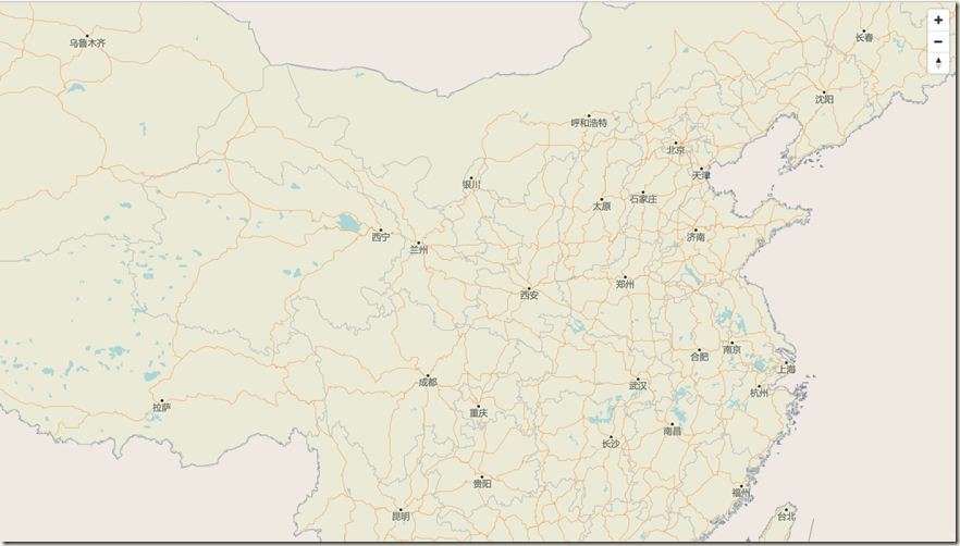
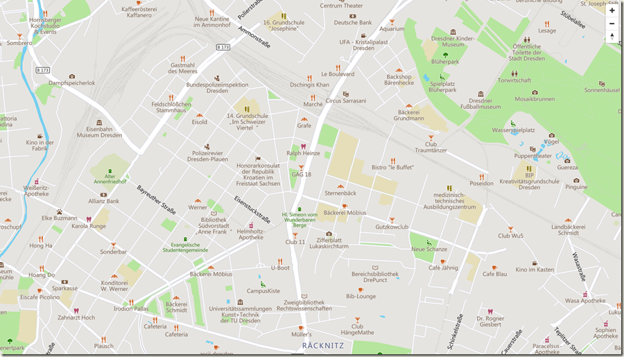
项目成果展示(所有项目文件都在阿里云的共享云虚拟主机上,访问地图可以会有点慢,请多多包涵)。
01:中国地图:http://test.sharegis.cn/mapbox/html/3china.html
02:德国-德累斯顿市:http://test.sharegis.cn/mapbox/html/6germany.html
1.中国地图离线实例
将所有的在线资源替换为本地资源,这里主要关注一下三种矢量切片的获取方式,
1.通过tms服务http://localhost:8080/geoserver/gwc/service/tms/1.0.0/china:china_map@EPSG:900913@pbf/{z}/{x}/{y}.pbf的方式获取矢量切片,
3.以及通过XYZ:http://test.sharegis.cn/mapbox/maptile/{z}/{x}/{y}.pbf直接访问切片虚拟目录获取切片,我们提供的在线例子就是通过这种方式,因为我只有虚拟云主机不能安装Geoserver,我把切好的切片放到网站根目录,通过XYZ直接请求切片文件。
这里mapbox样式代码省略,具体Mapbox样式请下载源码,或者参考上一篇文章-Mapbox样式设计进行设计。源码中maptile文件下包含所有中国地图离线矢量切片。
<!DOCTYPE html>

<html>

<head>

     <meta http-equiv="Content-Type" content="text/html; charset=utf-8" />

     <title>中国地图</title>

     <meta charset="utf-8" />

     <!--<script src='https://api.mapbox.com/mapbox-gl-js/v0.44.2/mapbox-gl.js'></script>-->

     <script src="../js/mapbox-gl.js"></script>

     <link href="../css/mapbox-gl.css" rel="stylesheet" />

     <style>

         html, body {

             padding: 0;

             margin: 0;

             height: 100%;

             overflow: hidden;

         }

        #map {

             height: 100%;

             z-index: 0;

         }

     </style>

</head>

<body>

     <div id='map'></div>

     <script>

         var map = new mapboxgl.Map({

             container: 'map',

             center: [105.7350860781, 34.3459367715],

             zoom: 3,

             style: {

                 "version": 8,

                 //我使用的这个版本sprite要写全路径

                 "sprite": "http://localhost:63336/sprites/sprite",

                 //字体.pbf文件获取

                 "glyphs": "../fonts/{fontstack}/{range}.pbf",

                 "sources": {

                     "china": {

                         //矢量类型

                         "type": "vector",

                          //服务类型 tms,要使用wmts服务请换成wmts

                         "scheme": "tms",

                         "tiles": [

                             //获取GeoServer 矢量切片服务,可以是一下几种方式

                            //"http://localhost:8080/geoserver/gwc/service/tms/1.0.0/china:china_map@EPSG:900913@pbf/{z}/{x}/{y}.pbf",

                           "http://localhost:61477/maptile/{z}/{x}/{y}.pbf"

                            //"http://127.0.0.1:8080/geoserver/gwc/service/wmts?REQUEST=GetTile&SERVICE=WMTS&VERSION=1.0.0&LAYER=china:china_map&STYLE=&TILEMATRIX=EPSG:900913:{z}&TILEMATRIXSET=EPSG:900913&FORMAT=application/x-protobuf;type=mapbox-vector&TILECOL={x}&TILEROW={y}"

                         ]

                     }

                 },

                 "layers": [{

                     "id": "background",

                     //地图背景

                     "type": "background",

                     "layout": {},

                     "paint": {

                         "background-color": {

                             "base": 1,

                             "stops": [

                                 [

                                     11,

                                     "hsl(35, 32%, 91%)"

                                 ],

                                 [

                                     13,

                                     "hsl(35, 12%, 89%)"

                                 ]

                             ]

                         }

                     },

                     "interactive": true

                 }, {

                     "id": "river",

                     "type": "line",

                     "source": "china",

                     "source-layer": "river",

                     "minzoom": 5,

                     "maxzoom": 15,

                     "paint": {

                         "line-color": "#a0cfdf",

                         "line-width": {

                             "base": 1.4,

                             "stops": [

                                 [

                                     8,

                                     0.5

                                 ],

                                 [

                                     20,

                                     15

                                 ]

                             ]

                         }

                     }

                 }

                //篇幅限制,其他样式这里不做展示了,详细的请看代码…….

                 ],

                 "_ssl": true

             }

         });

        //添加缩放控件

         map.addControl(new mapboxgl.NavigationControl());

     </script>

</body>

</html>
2.德国-德累斯顿市实例
<!DOCTYPE html>

<html>

<head>

     <meta http-equiv="Content-Type" content="text/html; charset=utf-8" />

     <title>德国-dresden</title>

     <meta charset="utf-8" />

     <!--<script src='https://api.mapbox.com/mapbox-gl-js/v0.44.2/mapbox-gl.js'></script>-->

     <script src="../js/mapbox-gl.js"></script>

     <link href="../css/mapbox-gl.css" rel="stylesheet" />

     <style>

         html, body {

             padding: 0;

             margin: 0;

             height: 100%;

             overflow: hidden;

         }

        #map {

             height: 100%;

             z-index: 0;

         }

     </style>

</head>

<body>

     <div id='map'></div>

     <script>

         var map = new mapboxgl.Map({

             container: 'map',

             center: [13.741891, 51.054211],

             zoom: 10,

             style: {

                 "version": 8,

                 //我使用的这个版本sprite要写全路径

                 "sprite": "http://localhost:61477/sprites/sprite",

                 //字体.pbf文件获取

                 "glyphs": "../fonts/{fontstack}/{range}.pbf",

                 "sources": {

                     "germany": {

                         //矢量类型

                         "type": "vector",

                         //服务类型 tms,要使用wmts请换成wmts

                         "scheme": "tms",

                         "tiles": [

                             //获取GeoServer 矢量切片服务,可以是一下几种方式

                             "http://localhost:8080/geoserver/gwc/service/tms/1.0.0/germany:germany_map@EPSG:900913@pbf/{z}/{x}/{y}.pbf",

                           //虚拟目录

                           //"http://test.sharegis.cn/mapbox/maptile1/{z}/{x}/{y}.pbf"

                           //"http://localhost:8080/geoserver/gwc/service/wmts?REQUEST=GetTile&SERVICE=WMTS&VERSION=1.0.0&LAYER=germany:germany_map&STYLE=&TILEMATRIX=EPSG:900913:{z}&TILEMATRIXSET=EPSG:900913&FORMAT=application/x-protobuf;type=mapbox-vector&TILECOL={x}&TILEROW={y}"

                         ]

                     }

                 },

                 "layers": [

                             {

                                 "id": "background",

                                 "type": "background",

                                 "layout": {},

                                 "paint": {

                                     "background-color": {

                                         "base": 1,

                                         "stops": [

                                             [

                                                 11,

                                                 "hsl(35, 32%, 91%)"

                                             ],

                                             [

                                                 13,

                                                 "hsl(35, 12%, 89%)"

                                             ]

                                         ]

                                     }

                                 },

                                 "interactive": true

                             },

                     {

                         //水面

                         "id": "water",

                         "type": "fill",

                         "source": "germany",

                         "source-layer": "gis_osm_water_a_07_1",

                         "layout": {},

                         "paint": {

                             "fill-color": "hsl(196, 80%, 70%)"

                         },

                         "interactive": true

                     },

                     {

                         //墓地

                         "id": "cemetery",

                         "type": "fill",

                         "source": "germany",

                         "source-layer": "gis_osm_pofw_a_07_1",

                         "layout": {},

                         "paint": {

                             "fill-color": "hsl(75, 37%, 81%)"

                         },

                         "interactive": true

                     },

                     {

                         //建筑物

                         "id": "building",

                         "type": "fill",

                         "source": "germany",

                         "source-layer": "gis_osm_buildings_a_07_1",

                         "minzoom": 15,

                         "layout": {},

                         "paint": {

                             "fill-color": {

                                 "base": 1,

                                 "stops": [

                                     [

                                         15,

                                         "hsl(35, 11%, 88%)"

                                     ],

                                     [

                                         16,

                                         "hsl(35, 8%, 85%)"

                                     ]

                                 ]

                             },

                             "fill-opacity": {

                                 "base": 1,

                                 "stops": [

                                     [

                                         15.5,

                                         0

                                     ],

                                     [

                                         16,

                                         1

                                     ]

                                 ]

                             },

                             "fill-outline-color": "hsl(35, 6%, 79%)"

                         },

                         "interactive": true

                     }

                 ],

                 "_ssl": true

             }

         });

         map.addControl(new mapboxgl.NavigationControl());

     </script>

</body>

</html>
3小结
这篇主要讲了一下Mapbox离线项目的两个例子,将我们提供的两个在线项目例子的源码分享给大家,相信大家通过这几篇文章会对Mapbox js离线项目部署有了清晰的认识,下篇我主要分享一下常用的Mapbox .pbf字体库。
源码链接:https://pan.baidu.com/s/16a48D7Qodf4xX-3YZOX7ZQ 密码:po5s
github地址:https://github.com/HuHongYong/Mapbox-js-offline
待续。。。。。。。。。。。。。。。。。。。。。
作者:ATtuing
出处:http://www.cnblogs.com/ATtuing
本文版权归作者和博客园共有,欢迎转载,但未经作者同意必须保留此段声明,且在文章页面明显位置给出原文链接。
开源方案搭建可离线的精美矢量切片地图服务-5.Mapbox离线项目实现的更多相关文章
- 开源方案搭建可离线的精美矢量切片地图服务-3.Mapbox个性化地图定制入门
1.简介 mapbox是一家非常牛的公司,比如像特斯拉.DJI大疆创新.孤独星球.Airbnb.GitHub.Cisco.Snap.飞猪.Keep.Bosch这些在国内外各自领域中响当当的企业都是它的 ...
- 开源方案搭建可离线的精美矢量切片地图服务-8.mapbox 之sprite大图图标文件生成(附源码)
项目成果展示(所有项目文件都在阿里云的共享云虚拟主机上,访问地图可以会有点慢,请多多包涵). 01:中国地图:http://test.sharegis.cn/mapbox/html/3china.ht ...
- 开源方案搭建可离线的精美矢量切片地图服务-6.Mapbox之.pbf字体库
项目成果展示(所有项目文件都在阿里云的共享云虚拟主机上,访问地图可以会有点慢,请多多包涵). 01:中国地图:http://test.sharegis.cn/mapbox/html/3china.ht ...
- 开源方案搭建可离线的精美矢量切片地图服务-4.Mapbox样式设计
项目成果展示(所有项目文件都在阿里云的共享云虚拟主机上,访问地图可以会有点慢,请多多包涵). 01:中国地图:http://test.sharegis.cn/mapbox/html/3china.ht ...
- 开源方案搭建可离线的精美矢量切片地图服务-7.Arcgis Pro企业级应用
1.前言 上篇讲.pbf字体库的时候说到我们使用的字体通过Arcgis Pro 生成,Arcgis Pro样式基于Mapbox做的矢量切片地图渲染.这篇主要讲一下Arcgis Pro矢量切片生成的的具 ...
- 开源方案搭建可离线的精美矢量切片地图服务-2.PostGIS+GeoServer矢量切片
项目成果展示(所有项目文件都在阿里云的共享云虚拟主机上,访问地图可以会有点慢,请多多包涵). 01:中国地图:http://test.sharegis.cn/mapbox/html/3china.ht ...
- 矢量切片应用中geoserver与geowebcache分布式部署方案
在进行GIS项目开发中,常使用Geoserver作为开源的地图服务器,Geoserver是一个JavaEE项目,常通过Tomcat进行部署.而GeoWebCache是一个采用Java实现用于缓存WMS ...
- 使用tippecanoe把GeoJSON制作成供mapbox展示的矢量切片vectortile
本文记录一下把geojson格式的数据制作成本地的矢量切片,并在mapbox中展示的过程. 1.切片 1.1 矢量数据需要先转换为geojson,如果是shp格式可以使用QGIS或者下载shp2gwo ...
- 【转】10.4新特性-ArcGIS 10.4矢量切片介绍
原文地址:http://zhihu.esrichina.com.cn/article/567 1.矢量切片简介GIS的底图一直使用金字塔技术进行切图,使用户能够快速访问指定级别的地图或者影像.但是切图 ...
随机推荐
- hdu 4968 最大最小gpa
http://acm.hdu.edu.cn/showproblem.php?pid=4968 给定平均分和科目数量,要求保证及格的前提下,求平均绩点的最大值和最小值. dp[i][j]表示i个科目,总 ...
- XE7 & FMX 那些年我们一起上过的控件:ListView 之 (3) 加载数据时如何显示自定义样式
本文介绍一下ListView下如何加载数据.及使用进度条反馈当前进度给用户. 注意: 原创作品,请尊重作者劳动成果,转载请注明出处!!!原文永久固定地址:http://www.cnblogs.com/ ...
- oracle的删除方法
手工彻底删除oracle 第一步:停用全部oracle服务 第二步:删除oracle注册表运行regedit在如下路径中找到oracle相关键值,删除 HKEY_LOCAL_MACHINE\SOFTW ...
- HMAILSERVER集成WEB邮件系统(ROUNDCUBE WEBMAIL)
hMailServer集成web邮件系统(Roundcube Webmail) 文/玄魂 前言 在上篇文章(使用hMailServer搭建邮件服务器)中,介绍了hMailServer的安装和简单配置. ...
- kafka各个版本特点介绍和总结
kafka各个版本特点介绍和总结 1.1 kafka的功能特点: 分布式消息队列 消息队列的数据模型, 形成流式数据. 提供Pub/Sub方式的海量消息处理.以高容错的方式存储海量数据流.保证数据流的 ...
- WinForm中实现Loading加载界面
1,LoaderForm窗体中添加PictureBox,然后添加Loading图片 2,窗体内属性设置 StartPosition :CenterScreen在屏幕中心显示 TopMost:True置 ...
- 定时任务 Wpf.Quartz.Demo.2
定时任务 Wpf.Quartz.Demo.1已经能运行了,本节开始用wpf搭界面. 准备工作: 1.界面选择MahApp.Metro 在App.xaml添加资源 <Application.Res ...
- AJPFX:外汇的价格图表类型和技术指标类型
AJPFX:价格图表的类型 柱状图 它是反映价格行为的一种最基本的图表.每一根柱代表一段时间——最短为1分钟,最长为数年.随着时间的推移,柱状图反映出不同的价格形态. 蜡烛图 不同于简单的柱状图,蜡烛 ...
- C++获取本机IP地址信息
#include<winsock2.h> #include<iostream> #include<string> using namespace std; #pra ...
- linux 如何开通新的端口
第一种方式:(以nginx为列,端口是) 1. 开放端口命令: /sbin/iptables -I INPUT -p tcp --dport -j ACCEPT 2. 保存:/etc/rc ...