【flink training】 打车热点区域实时统计PopularPlaces
http://training.data-artisans.com/是Apache Flink商业公司DataArtisans提供的一个flink学习平台,主要提供了一些业务场景和flink api结合的case。本文摘取其中一个计算出租车上/下客人热点区域demo进行分析。
一 数据准备
flink-traing的大部分例子是以New York City Taxi & Limousine Commission 提供的一份历史数据集作为练习数据源,其中最常用一种类型为taxi ride的事件定义为
rideId         : Long      // a unique id for each ride

taxiId         : Long      // a unique id for each taxi

driverId       : Long      // a unique id for each driver

isStart        : Boolean   // TRUE for ride start events, FALSE for ride end events

startTime      : DateTime  // the start time of a ride

endTime        : DateTime  // the end time of a ride,

                           //   "1970-01-01 00:00:00" for start events

startLon       : Float     // the longitude of the ride start location

startLat       : Float     // the latitude of the ride start location

endLon         : Float     // the longitude of the ride end location

endLat         : Float     // the latitude of the ride end location

passengerCnt   : Short     // number of passengers on the ride
下载数据集
wget http://training.data-artisans.com/trainingData/nycTaxiRides.gz
将数据源转化为flink stream source数据
// get an ExecutionEnvironment

StreamExecutionEnvironment env =

  StreamExecutionEnvironment.getExecutionEnvironment();

// configure event-time processing

env.setStreamTimeCharacteristic(TimeCharacteristic.EventTime);

// get the taxi ride data stream

DataStream<TaxiRide> rides = env.addSource(

  new TaxiRideSource("/path/to/nycTaxiRides.gz", maxDelay, servingSpeed));
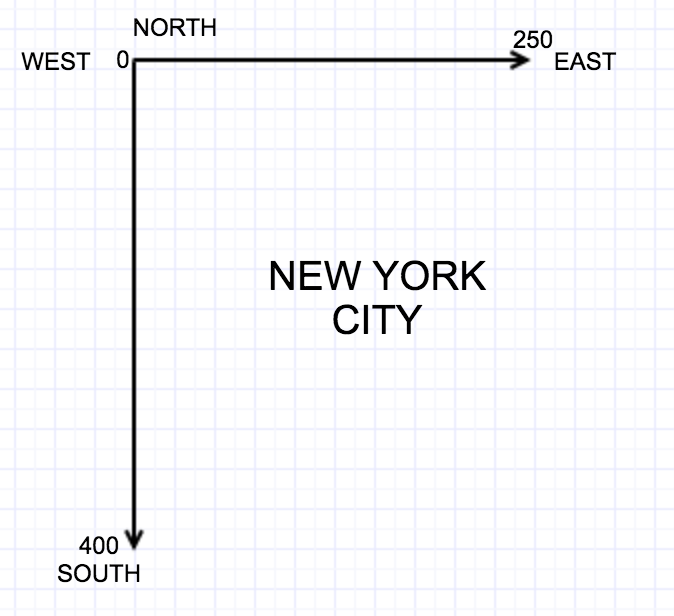
二 坐标分格
如下图所示,程序将整个城市坐标由西北向东南划分为大约250X400个单位的单元格
三 根据单元格计算坐标值
基础坐标数据
    // geo boundaries of the area of NYC

    public static double LON_EAST = -73.7;

    public static double LON_WEST = -74.05;

    public static double LAT_NORTH = 41.0;

    public static double LAT_SOUTH = 40.5;

    // area width and height

    public static double LON_WIDTH = 74.05 - 73.7;

    public static double LAT_HEIGHT = 41.0 - 40.5;

    // delta step to create artificial grid overlay of NYC

    public static double DELTA_LON = 0.0014;

    public static double DELTA_LAT = 0.00125;

    // ( |LON_WEST| - |LON_EAST| ) / DELTA_LON

    public static int NUMBER_OF_GRID_X = 250;

    // ( LAT_NORTH - LAT_SOUTH ) / DELTA_LAT

    public static int NUMBER_OF_GRID_Y = 400;
根据经纬度计算单元格唯一id
    public static int mapToGridCell(float lon, float lat) {

        int xIndex = (int)Math.floor((Math.abs(LON_WEST) - Math.abs(lon)) / DELTA_LON);

        int yIndex = (int)Math.floor((LAT_NORTH - lat) / DELTA_LAT);

        return xIndex + (yIndex * NUMBER_OF_GRID_X);

    }
四 程序实现
将坐标映射到gridId之后剩下的就是采用窗口统计单位时间内event事件超过一定阈值的grid。
// find popular places

        DataStream<Tuple5<Float, Float, Long, Boolean, Integer>> popularSpots = rides

                // remove all rides which are not within NYC

                .filter(new RideCleansing.NYCFilter())

                // match ride to grid cell and event type (start or end)

                .map(new GridCellMatcher())

                // partition by cell id and event type

                .<KeyedStream<Tuple2<Integer, Boolean>, Tuple2<Integer, Boolean>>>keyBy(0, 1)

                // build sliding window

                .timeWindow(Time.minutes(15), Time.minutes(5))

                // count ride events in window

                .apply(new RideCounter())

                // filter by popularity threshold

                .filter((Tuple4<Integer, Long, Boolean, Integer> count) -> (count.f3 >= popThreshold))

                // map grid cell to coordinates

                .map(new GridToCoordinates());

        // print result on stdout

        popularSpots.print();
上述flink job在统计完热点区域后又将gridId映射回每个单元格的中心点经纬度,具体实现为:
    /**

     * Maps the grid cell id back to longitude and latitude coordinates.

     */

    public static class GridToCoordinates implements

            MapFunction<Tuple4<Integer, Long, Boolean, Integer>, Tuple5<Float, Float, Long, Boolean, Integer>> {

        @Override

        public Tuple5<Float, Float, Long, Boolean, Integer> map(

                Tuple4<Integer, Long, Boolean, Integer> cellCount) throws Exception {

            return new Tuple5<>(

                    GeoUtils.getGridCellCenterLon(cellCount.f0),

                    GeoUtils.getGridCellCenterLat(cellCount.f0),

                    cellCount.f1,

                    cellCount.f2,

                    cellCount.f3);

        }

    }

    /**

     * Returns the longitude of the center of a grid cell.

     *

     * @param gridCellId The grid cell.

     *

     * @return The longitude value of the cell's center.

     */

    public static float getGridCellCenterLon(int gridCellId) {

        int xIndex = gridCellId % NUMBER_OF_GRID_X;

        return (float)(Math.abs(LON_WEST) - (xIndex * DELTA_LON) - (DELTA_LON / 2)) * -1.0f;

    }

    /**

     * Returns the latitude of the center of a grid cell.

     *

     * @param gridCellId The grid cell.

     *

     * @return The latitude value of the cell's center.

     */

    public static float getGridCellCenterLat(int gridCellId) {

        int xIndex = gridCellId % NUMBER_OF_GRID_X;

        int yIndex = (gridCellId - xIndex) / NUMBER_OF_GRID_X;

        return (float)(LAT_NORTH - (yIndex * DELTA_LAT) - (DELTA_LAT / 2));

    }
结论: 综上所示,通过单元格划分,flink程序可以方便的解决实时统计热点地理区域这一类问题。
代码地址:https://github.com/dataArtisans/flink-training-exercises/blob/master/src/main/java/com/dataartisans/flinktraining/exercises/datastream_java/windows/PopularPlaces.java
【flink training】 打车热点区域实时统计PopularPlaces的更多相关文章
- 通过Flink实现个推海量消息数据的实时统计
背景 消息报表主要用于统计消息任务的下发情况.比如,单条推送消息下发APP用户总量有多少,成功推送到手机的数量有多少,又有多少APP用户点击了弹窗通知并打开APP等.通过消息报表,我们可以很直观地看到 ...
- 利用flash精确定位asp.net的图像热点区域
Asp.net的热点区域控件非常有用,但是对于热点区域如何精确定位,设定矩形,圆和多边形要素点的位置,用flash能够精确定位,在flash中制作热点区域的部分,可以是矩形,图形或者文字,然后对于这部 ...
- PHP+Mysql+jQuery实现地图区域数据统计-展示数据
我们要在地图上有限的区块内展示更多的信息,更好的办法是通过地图交互来实现.本文将给大家讲解通过鼠标滑动到地图指定省份区域,在弹出的提示框中显示对应省份的数据信息.适用于数据统计和地图区块展示等场景. ...
- jQuery - 实时统计输入框输入个数(中文输入法适用)
经常在实时统计文本框输入多少字的时候,有时会出现不及时统计,特别是在中文输入法下. 为了实时准确统计,可以修改代码如下: $(function() { $("#txtT ...
- JavaScript 实现textarea限制输入字数, 输入框字数实时统计更新,输入框实时字数计算移动端bug解决
textarea称文本域,又称文本区,即有滚动条的多行文本输入控件,在网页的提交表单中经常用到.与单行文本框text控件不同,它不能通过maxlength属性来限制字数,为此必须寻求其他方法来加以限制 ...
- DSAPI 获取实时统计信息CPU/内存/硬盘/网络
有时,我们需要获取当前计算机中CPU.内存.硬盘.网络等实时信息,如下图:\ 要实现上述几项信息的获取,通常需要使用Timer控件来间隔获取,以便刷新最新的数据. 本示例中,放一个Timer控件,放一 ...
- Kafka项目实战-用户日志上报实时统计之编码实践
1.概述 本课程的视频教程地址:<Kafka实战项目之编码实践> 该课程我以用户实时上报日志案例为基础,带着大家去完成各个KPI的编码工作,实现生产模块.消费模块,数据持久化,以及应用调 ...
- Kafka项目实战-用户日志上报实时统计之分析与设计
1.概述 本课程的视频教程地址:<Kafka实战项目之分析与设计> 本课程我通过一个用户实时上报日志案例作为基础,带着大家去分析Kafka这样一个项目的各个环节,从而对项目的整体设计做比 ...
- Kafka项目实战-用户日志上报实时统计之应用概述
1.概述 本课程的视频教程地址:<Kafka实战项目之应用概述> 本课程是通过一个用户实时上报日志来展开的,通过介绍 Kafka 的业务和应用场景,并带着大家搭建本 Kafka 项目的实战 ...
随机推荐
- palm os
在3G展会上,Palm将告别Palm OS操作系统 2009年2月12日消息,据国外媒体报道,周三,Palm CEO埃德•科林根(Ed Colligan)在旧金山的一个投资者会议上表示,Palm将告别 ...
- FPGA作为从机与STM32进行SPI协议通信---Verilog实现
一.SPI协议简要介绍 SPI,是英语Serial Peripheral Interface的缩写,顾名思义就是串行外围设备接口.SPI,是一种高速的,全双工,同步的通信总线,并且在芯片的管脚上只占用 ...
- axios踩坑记录+拦截器使用+vue cli代理跨域proxy+webpack打包部署到服务器
1.小小的提一下vue cli脚手架前端调后端数据接口时候的本地代理跨域问题,如我在本地localhost访问接口http://40.00.100.100:3002/是要跨域的,相当于浏览器设置了一道 ...
- Animation学习笔记
关于动画的实现,Android提供了Animation,在Android SDK介绍了2种Animation模式: 1. Tween Animation:通过对场景里的对象不断做图像变换(平移.缩放. ...
- 算法笔记_165:算法提高 道路和航路(Java)
目录 1 问题描述 2解决方案 1 问题描述 问题描述 农夫约翰正在针对一个新区域的牛奶配送合同进行研究.他打算分发牛奶到T个城镇(标号为1..T),这些城镇通过R条标号为(1..R)的道路和P条 ...
- 算法笔记_113:算法集训之代码填空题集一(Java)
目录 1 报数游戏 2 不连续处断开 3 猜数字游戏 4 串的反转 5 串中找数字 6 递归连续数 7 复制网站内容 8 股票的风险 9 基因牛的繁殖 10 括号的匹配 1 报数游戏 有n个孩子 ...
- ant-design getFieldDecorator 无法获取自定义组件的值
1.自定义或第三方的表单控件,也可以与 Form 组件一起使用.只要该组件遵循以下的约定: (1)提供受控属性 value 或其它与 valuePropName 的值同名的属性. (2)提供 onCh ...
- 细说linux IPC(一):基于socket的进程间通信(上)
[版权声明:尊重原创.转载请保留出处:blog.csdn.net/shallnet 或 .../gentleliu,文章仅供学习交流,请勿用于商业用途] 在一个较大的project其中 ...
- 【VBA编程】14.操作工作簿对象
[访问工作簿] 对已经打开的工作簿,可以通过使用索引号来访问工作簿,也可以通过名称来访问工作簿 [代码区域] Sub 访问工作簿() Dim counter As Integer counter = ...
- 使用scrapy进行12306车票查询
概述 通过12306的查询API进行查询某日火车票, 结果保存在csv文件中. 详细 代码下载:http://www.demodashi.com/demo/12623.html 一.环境搭建 1. 安 ...