
关于ArcGIS API for JavaScript中basemap的总结介绍(一)
实际上basemap这个概念并不只在arcgis中才有,在Python中有一个matplotlib basemap toolkit(https://pypi.python.org/pypi/basemap),是用来实现地理信息可视化的。其中,matplotlib是Python常用的数据绘制包,basemap是matplotlib的一个子包,用来进行地图绘制。本文所指的basemap是指esri提供的基础底图图层。
正式使用basemap是在前一阵做webgis开发的时候,需要在自己的矢量图层下面加一个底图图层,发现网上的相关文档不多,所以整理了一下帮助文档和demo,分享给大家。
首先,看一下arcgis帮助文档中对GIS basemap的介绍(http://resources.arcgis.com/zh-cn/help/main/10.1/index.html#/na/00s500000017000000/),因为重点介绍arcgis API,所以关于arcmap的操作方法和步骤不再赘述,只是简单介绍一下基础底图的概念:
底图图层属于一类地图图层,提供了一个可显示动态操作信息的框架。底图显示性能非常强大。由于底图图层相对稳定,不常发生变化,因此其显示只需计算一次,然后便可以多次重复使用。首次以特定的地图比例访问某个区域时,会对底图图层的显示进行计算。以后再以此地图比例访问该区域时,可调出该显示。众多 ArcMap 应用程序中都包括可用于显示和使用操作性信息、观测值和从分析模型中获取的信息的底图。底图用于位置参考,并为用户提供叠加或聚合业务图层、执行任务以及可视化地理信息的框架。底图是执行所有后续操作和地图制图的基础,它为地理信息的使用提供了环境和框架。底图相对稳定,并且在典型设置下,并不需要经常更新。此外,底图常常可在多种地图比例下使用。在各种地图比例范围内,底图都可以描绘出对应的内容。
接下来,重点介绍一下arcgis API for JS中esri提供的已有的17种basemap(包括"satellite","hybrid","streets","topo","osm"和"national-geographic"等等),包括代码和示例。
在下载的arcgis_js_api包中有一个basemaps.js文件(路径为arcgis_js_api\3.17\esri),里面定义了esri提供的全部的basemap,下面贴出了这个js文件中的详细代码:
 // All material copyright ESRI, All Rights Reserved, unless otherwise specified.

 // See http://js.arcgis.com/3.17/esri/copyright.txt for details.

 //>>built

 define("esri/basemaps", ["require", "dojo/has", "./kernel", "dojo/i18n!./nls/jsapi"], function(a, c, d, b) {

     a = {

         streets: {

             title: b.basemaps.streets,

             thumbnailUrl: a.toUrl("./images/basemap/streets.jpg"),

             itemId: "d8855ee4d3d74413babfb0f41203b168",

             baseMapLayers: [{

                     url: "http://services.arcgisonline.com/ArcGIS/rest/services/World_Street_Map/MapServer"

                 }

             ]

         },

         satellite: {

             title: b.basemaps.satellite,

             thumbnailUrl: a.toUrl("./images/basemap/satellite.jpg"),

             itemId: "86de95d4e0244cba80f0fa2c9403a7b2",

             baseMapLayers: [{

                     url: "http://services.arcgisonline.com/ArcGIS/rest/services/World_Imagery/MapServer"

                 }

             ]

         },

         hybrid: {

             title: b.basemaps.hybrid,

             thumbnailUrl: a.toUrl("./images/basemap/hybrid.jpg"),

             itemId: "413fd05bbd7342f5991d5ec96f4f8b18",

             baseMapLayers: [{

                     url: "http://services.arcgisonline.com/ArcGIS/rest/services/World_Imagery/MapServer"

                 }, {

                     url: "http://services.arcgisonline.com/ArcGIS/rest/services/Reference/World_Boundaries_and_Places/MapServer",

                     isReference: !0

                 }

             ]

         },

         terrain: {

             title: b.basemaps.terrain,

             thumbnailUrl: a.toUrl("./images/basemap/terrain.jpg"),

             itemId: "aab054ab883c4a4094c72e949566ad40",

             baseMapLayers: [{

                     url: "http://services.arcgisonline.com/ArcGIS/rest/services/World_Terrain_Base/MapServer"

                 }, {

                     url: "http://services.arcgisonline.com/ArcGIS/rest/services/Reference/World_Reference_Overlay/MapServer",

                     isReference: !0

                 }

             ]

         },

         topo: {

             title: b.basemaps.topo,

             thumbnailUrl: a.toUrl("./images/basemap/topo.jpg"),

             itemId: "6e03e8c26aad4b9c92a87c1063ddb0e3",

             baseMapLayers: [{

                     url: "http://services.arcgisonline.com/ArcGIS/rest/services/World_Topo_Map/MapServer"

                 }

             ]

         },

         gray: {

             title: b.basemaps.gray,

             thumbnailUrl: a.toUrl("./images/basemap/gray.jpg"),

             itemId: "8b3b470883a744aeb60e5fff0a319ce7",

             baseMapLayers: [{

                     url: "http://services.arcgisonline.com/ArcGIS/rest/services/Canvas/World_Light_Gray_Base/MapServer"

                 }, {

                     url: "http://services.arcgisonline.com/ArcGIS/rest/services/Canvas/World_Light_Gray_Reference/MapServer",

                     isReference: !0

                 }

             ]

         },

         "dark-gray": {

             title: b.basemaps["dark-gray"],

             thumbnailUrl: a.toUrl("./images/basemap/dark-gray.jpg"),

             itemId: "da65bacab5bd4defb576f839b6b28098",

             baseMapLayers: [{

                     url: "http://services.arcgisonline.com/ArcGIS/rest/services/Canvas/World_Dark_Gray_Base/MapServer"

                 }, {

                     url: "http://services.arcgisonline.com/ArcGIS/rest/services/Canvas/World_Dark_Gray_Reference/MapServer",

                     isReference: !0

                 }

             ]

         },

         oceans: {

             title: b.basemaps.oceans,

             thumbnailUrl: a.toUrl("./images/basemap/oceans.jpg"),

             itemId: "48b8cec7ebf04b5fbdcaf70d09daff21",

             baseMapLayers: [{

                     url: "http://services.arcgisonline.com/arcgis/rest/services/Ocean/World_Ocean_Base/MapServer"

                 }, {

                     url: "http://services.arcgisonline.com/arcgis/rest/services/Ocean/World_Ocean_Reference/MapServer",

                     isReference: !0

                 }

             ]

         },

         "national-geographic": {

             title: b.basemaps["national-geographic"],

             thumbnailUrl: a.toUrl("./images/basemap/national-geographic.jpg"),

             itemId: "509e2d6b034246d692a461724ae2d62c",

             baseMapLayers: [{

                     url: "http://services.arcgisonline.com/ArcGIS/rest/services/NatGeo_World_Map/MapServer"

                 }

             ]

         },

         osm: {

             title: b.basemaps.osm,

             thumbnailUrl: a.toUrl("./images/basemap/osm.jpg"),

             itemId: "5d2bfa736f8448b3a1708e1f6be23eed",

             baseMapLayers: [{

                     type: "OpenStreetMap"

                 }

             ]

         },

         "dark-gray-vector": {

             title: b.basemaps["dark-gray"],

             thumbnailUrl: a.toUrl("./images/basemap/dark-gray.jpg"),

             itemId: "850db44b9eb845d3bd42b19e8aa7a024",

             baseMapLayers: [{

                     url: "http://www.arcgis.com/sharing/rest/content/items/850db44b9eb845d3bd42b19e8aa7a024/resources/styles/root.json",

                     type: "VectorTile"

                 }

             ]

         },

         "gray-vector": {

             title: b.basemaps.gray,

             thumbnailUrl: a.toUrl("./images/basemap/gray.jpg"),

             itemId: "0e02e6f86d02455091796eaae811d9b5",

             baseMapLayers: [{

                     url: "http://www.arcgis.com/sharing/rest/content/items/0e02e6f86d02455091796eaae811d9b5/resources/styles/root.json",

                     type: "VectorTile"

                 }

             ]

         },

         "streets-vector": {

             title: b.basemaps.streets,

             thumbnailUrl: a.toUrl("./images/basemap/streets.jpg"),

             itemId: "4e1133c28ac04cca97693cf336cd49ad",

             baseMapLayers: [{

                     url: "http://www.arcgis.com/sharing/rest/content/items/4e1133c28ac04cca97693cf336cd49ad/resources/styles/root.json",

                     type: "VectorTile"

                 }

             ]

         },

         "topo-vector": {

             title: b.basemaps.topo,

             thumbnailUrl: a.toUrl("./images/basemap/topo.jpg"),

             itemId: "6f65bc1351b7411588a8cb43fe23dad7",

             baseMapLayers: [{

                     url: "http://www.arcgis.com/sharing/rest/content/items/6f65bc1351b7411588a8cb43fe23dad7/resources/styles/root.json",

                     type: "VectorTile"

                 }

             ]

         },

         "streets-night-vector": {

             title: b.basemaps["streets-night-vector"],

             thumbnailUrl: a.toUrl("./images/basemap/streets-night.jpg"),

             itemId: "bf79e422e9454565ae0cbe9553cf6471",

             baseMapLayers: [{

                     url: "http://www.arcgis.com/sharing/rest/content/items/bf79e422e9454565ae0cbe9553cf6471/resources/styles/root.json",

                     type: "VectorTile"

                 }

             ]

         },

         "streets-relief-vector": {

             title: b.basemaps["streets-relief-vector"],

             thumbnailUrl: a.toUrl("./images/basemap/streets-relief.jpg"),

             itemId: "2e063e709e3446459f8538ed6743f879",

             baseMapLayers: [{

                     url: "http://www.arcgis.com/sharing/rest/content/items/2e063e709e3446459f8538ed6743f879/resources/styles/root.json",

                     type: "VectorTile"

                 }

             ]

         },

         "streets-navigation-vector": {

             title: b.basemaps["streets-navigation-vector"],

             thumbnailUrl: a.toUrl("./images/basemap/streets-navigation.jpg"),

             itemId: "dcbbba0edf094eaa81af19298b9c6247",

             baseMapLayers: [{

                     url: "http://www.arcgis.com/sharing/rest/content/items/dcbbba0edf094eaa81af19298b9c6247/resources/styles/root.json",

                     type: "VectorTile"

                 }

             ]

         }

     };

     c("extend-esri") && (d.basemaps = a);

     return a

 });
(basemaps.js)
然后是官方帮助文档中对这17种basemap的简单介绍(https://developers.arcgis.com/javascript/3/jsapi/esri.basemaps-amd.html):
| Name | Type | Summary |
|---|---|---|
| dark-gray | Object |
The Dark Gray Canvas basemap is designed to be used as a soothing background map for overlaying and focus attention on other map layers. |
| dark-gray-vector | Object |
This vector tile layer provides a detailed basemap for the world featuring a neutral background style with minimal colors, labels, and features. |
| gray | Object |
The Light Gray Canvas basemap is designed to be used as a neutral background map for overlaying and emphasizing other map layers. |
| gray-vector | Object |
This vector tile layer provides a detailed basemap for the world featuring a neutral background style with minimal colors, labels, and features. |
| hybrid | Object |
The World Imagery map is a detailed imagery map layer and labels that is designed to be used as a basemap for various maps and applications. |
| national-geographic | Object |
The National Geographic basemap is designed to be used as a general reference map for informational and educational purposes. |
| oceans | Object |
The Ocean Basemap is designed to be used as a basemap by marine GIS professionals and as a reference map by anyone interested in ocean data. |
| osm | Object |
The OpenStreetMap is a community map layer that is designed to be used as a basemap for various maps and applications. |
| satellite | Object |
The World Imagery map is a detailed imagery map layer that is designed to be used as a basemap for various maps and applications. |
| streets | Object |
The Streets basemap presents a multiscale street map for the world. |
| streets-navigation-vector | Object |
This vector tile layer provides a detailed basemap for the world featuring a custom navigation map style. |
| streets-night-vector | Object |
This vector tile layer provides a detailed basemap for the world featuring a custom "night time" street map style. |
| streets-relief-vector | Object |
This vector tile layer provides a detailed basemap for the world featuring a classic Esri street map style designed for use with a relief map. |
| streets-vector | Object |
This vector tile layer provides a detailed basemap for the world featuring a classic Esri street map style. |
| terrain | Object |
The Terrain with Labels basemap is designed to be used to overlay and emphasize other thematic map layers. |
| topo | Object |
The Topographic map includes boundaries, cities, water features, physiographic features, parks, landmarks, transportation, and buildings. |
| topo-vector | Object |
This vector tile layer provides a detailed basemap for the world featuring a classic Esri topographic map style designed for use with a relief map. |
最后,对于GIS开发人员来说,在webgis开发中如果需要使用esri提供的basemap,就可以直接在脚本中通过指定Map构造函数参数中的basemap的值来引用相应的底图图层。下面写了一段代码,可以新建一个html文件,把这段代码拷进去,然后可以在浏览器中运行查看地图显示效果。将代码第20行中的“topo”改成上面表格中其它basemap的名字,可以查看相应basemap的实际效果。
 <!DOCTYPE html>

 <html>

 <head>

     <meta charset="utf-8">

     <title>Basemap Introduction</title>

     <link rel="stylesheet" href="http://js.arcgis.com/3.9/js/esri/css/esri.css">

     <style>

         html, body, #mapDiv {

             padding: 0;

             margin: 0;

             height: 100%;

         }

     </style>

     <script src="http://js.arcgis.com/3.9/"></script>

     <script>

         require(["esri/map","dojo/domReady!"], function (Map) {

             var map=new Map("mapDiv",{

                 center:[120,32],

                 zoom:5,

                 basemap:"topo"

             });

         });

     </script>

 </head>

 <body class="tundra">

     <div id="mapDiv"></div>

 </body>

 </html>
我通过上述方式改动代码并依次运行程序,发现还是有点问题,即这17种basemap中只有8种可以通过上述代码的这种方式调用,其余的不能运行。比如,我把“topo”改成“topo-vector”后运行程序,浏览器中地图不能显示,控制台提示信息是Map.setBasemap: Unable to find basemap definition for: "topo-vector". Try one of these: streets,satellite,hybrid,topo,gray,oceans,national-geographic,osm。后来有查文档和求助大神,不过还是没搞通其余的basemap应该怎么调用,比较遗憾。烦请有知道的朋友告诉我一下,我也要继续研究一下,搞懂之后我再写个续篇吧。
下面是这8种basemap(national-geographic,gray,hybrid,oceans,osm,satellite,streets,topo)的运行效果示例:
| national-geographic |  |
| gray | 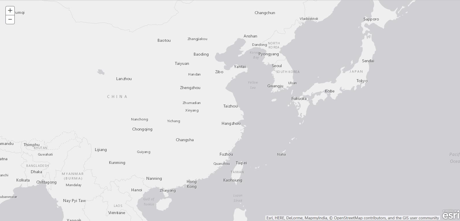 |
| hybrid |  |
| oceans |  |
| osm |  |
| satellite | 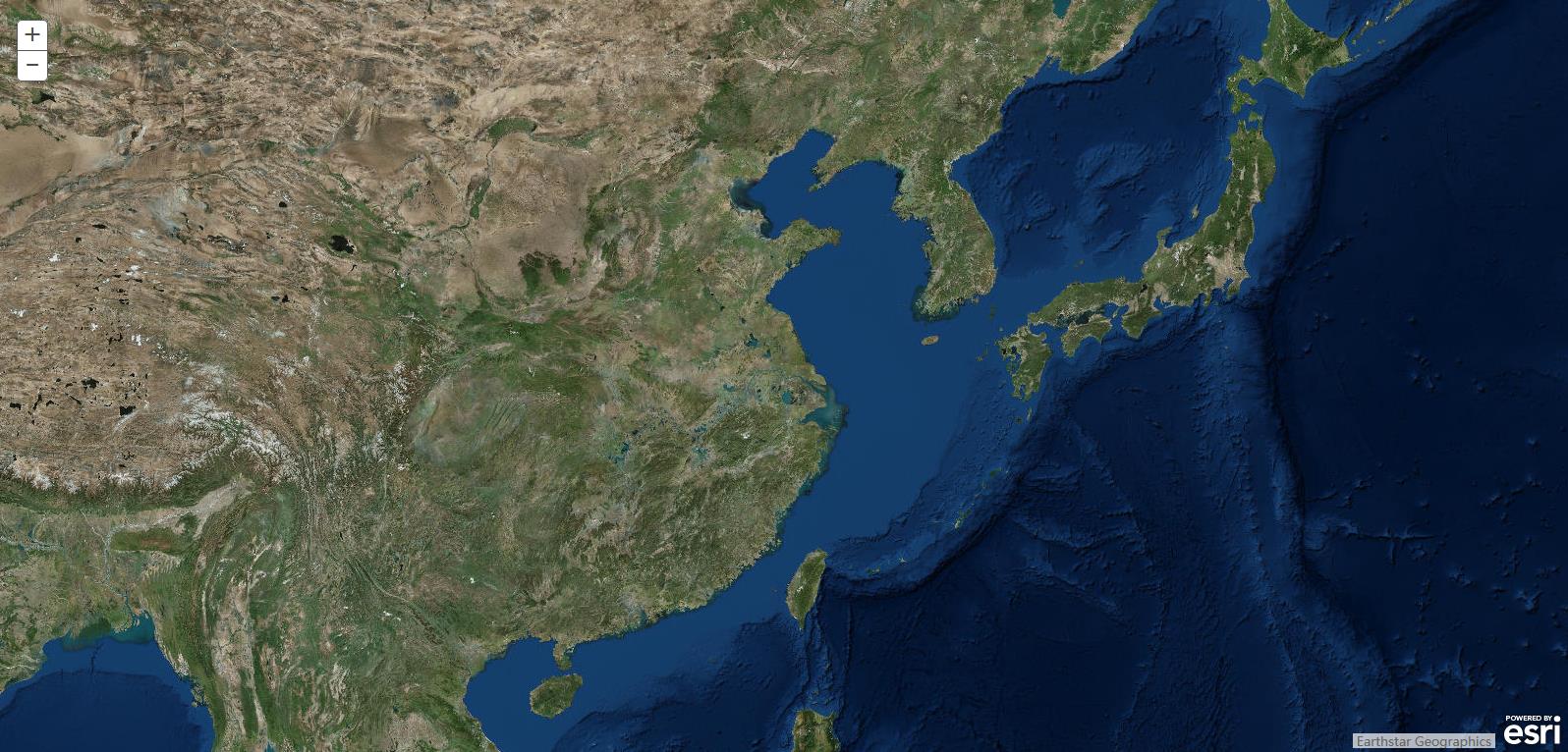 |
| streets | 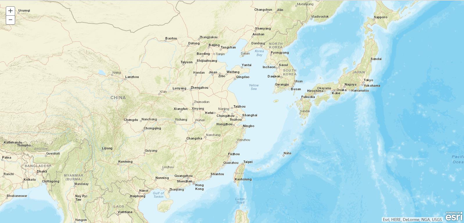 |
| topo | 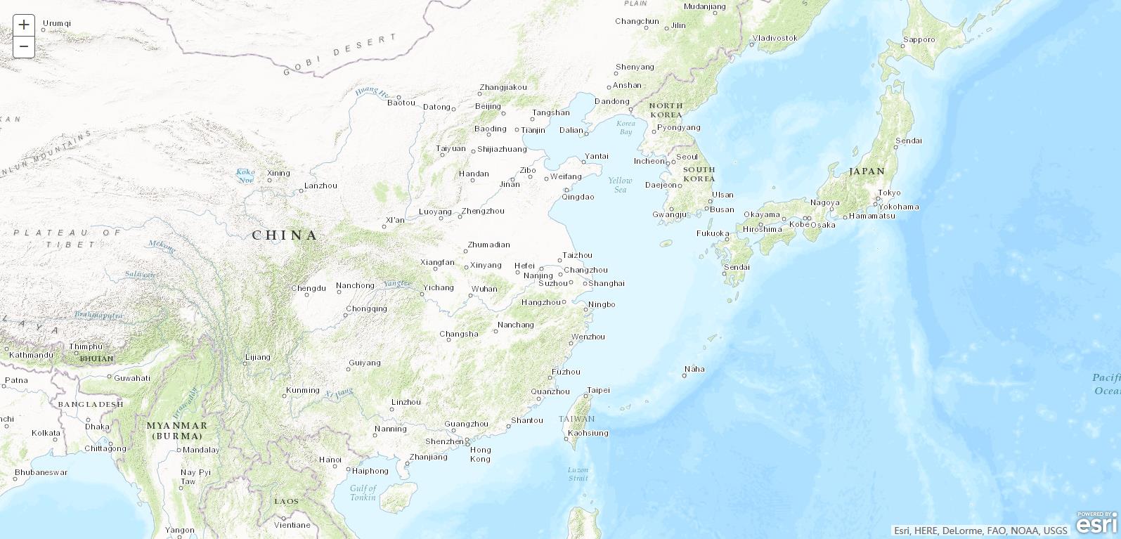 |
关于ArcGIS API for JavaScript中basemap的总结介绍(一)的更多相关文章
- ArcGIS API for JavaScript 中的数据类型【vs】GPServer的数据类型
熟悉GPServer的同学肯定知道,GPServer在10.1的ArcMap后需要执行成功一次才能发布. 发布GPServer,可以是ArcMap的工具箱的工具,也可以是自己写的模型. 不管是ArcM ...
- arcgis api for javascript中使用proxy.jsp
当我们使用arcgis api for javascript 查询arcgis服务时,如果查询的参数很长时,通过get方式提交会查询不到结果,因为get方式提交的参数有长度限制,需要通过代理的方式使用 ...
- ArcGIS API for javascript中搜索框的使用问题
我们在开发中常常需要用搜索框去搜索地图上的某个数据,然后在地图上显示出来.这个时候我们要用到esri.dijit.Search().在设置里面的sources的时候,需要注意一点:必须要使用在线的fe ...
- 本人arcgis api for javascript中常见错误总结
1. 2.对象不支持"replace"属性或方法 解决办法:一般在ie中执行js会报这样的错误,基本问题就是你引用了某个对象中不存在的方法,可能是这个方法本来存在而你写错了,或者调 ...
- ArcGIS API for JavaScript开发环境搭建与发布以及基本功能实现
1.背景介绍 ArcGIS API for JavaScript 咱这就不介绍了,具体可看ESRI中国的介绍:http://support.esrichina.com.cn/2011/0223/960 ...
- ArcGIS API for JavaScript Bookmarks(书签)
说明:本篇博文介绍的是ArcGIS API for JavaScript中的 Bookmarks(书签) ,书签的作用是,把地图放大到一个地方 添加书签,书签名称可以和地图名称一直,单击标签 地图会定 ...
- arcgis api for javascript 学习(四) 地图的基本操作
1.文章讲解的为地图的平移.放大.缩小.前视图.后视图以及全景视图的基本功能操作 2.主要用到的是arcgis api for javascript中Navigation的用法,代码如下: <! ...
- ArcGIS API for JavaScript介绍
ArcGIS API for JavaScript中的类是按照模块组织的,主要包含esri.esri/geometry.esri/renderers.esri/symbols.esri/symbols ...
- ArcGIS API for JavaScript:Layer之间那点儿事
先来看一个模型: |–TiledMapServiceLayer | |–ArcGISTiledMapServiceLayer |–DynamicLayer | |–Dyn ...
随机推荐
- IOS 开发中 Whose view is not in the window hierarchy 错误的解决办法
在 IOS 开发当中经常碰到 whose view is not in the window hierarchy 的错误,该错误简单的说,是由于 "ViewController" ...
- WPF Excel导出加个手动修改地址
http://blog.csdn.net/sanjiawan/article/details/6818921 以上是CSDN上的WPF Excel导入导出,我看到有人提问怎么能够手动选择地址,正好用到 ...
- 判断checkbox的checked状态(jQuery写法)
$('#checkboxInput').click(function(){ if (this.checked){ $('.questionContainer').css({ "opacity ...
- Shell脚本一枚
脚本如下: #!/bin/bash dir=$1 dir1="" for file in `find $dir -type f` do dir2=${file%/*} name=$ ...
- EntityFramework 7 Linq Contains In 奇怪问题
这篇博文纪录一下:当使用 EF7,Linq 实现类似 where filename in('','','') SQL 代码,使用 Contains 出现报错问题. project.json 配置文件( ...
- GCD 扫盲篇
GCD有四个概念:串行队列.并行队列.同步.异步四者. 如下简介: 这里不仅给出了不确定性,而且也给出了确定性.对于初学者而言,有时候因为那些不确定的东西所造成的疑问会像没有闸却在疾驰的汽车一样让人惊 ...
- 如何在Windows Server 2008 上添加RD (远程桌面)会话主机配置的远程桌面授权服务器
在Windows Server系列的现存活跃产品中都默认的会开放两个随机附送的远程控制的授权,而一些特殊条件下我们需要启用多个远程终端连接,在购买了相应的授权之后,我们如何将配置好的服务器添加到远程桌 ...
- DB2 Enterprise Server Edition(DB2 ESE)9.1在Windows Server 2008 下出现无法新建数据库的情况,及解决办法
在安装有,DB2 9.1版本的Windows Server 2008 上面,使用默认的安装方式导致无法创建数据库,相关的错误提示: "SQL3012C 发生系统错误(原因码= "& ...
- ZOJ Problem Set - 1115 Digital Roots
水题记录: 注:此题题目并没有限定数值的大小,所以要用字符串进行处理 #include <stdio.h> #include <string.h> int main() { ] ...
- Struts2环境下Tomcat启动异常:Exception starting filter struts2,报了一个java.lang.ClassNotFoundException
在写一个struts2+hibernate整合的小例子时,启动Tomcat服务器,报了一个: 严重: Exception starting filter struts2java.lang.ClassN ...