
[原][OE][官方例子]osgearth_features OE地球添加shp文件(特征标识)
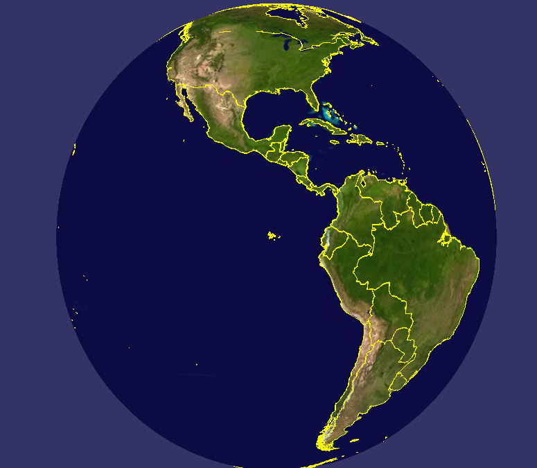
官方示例代码
/* -*-c++-*- */

/* osgEarth - Dynamic map generation toolkit for OpenSceneGraph

* Copyright 2016 Pelican Mapping

* http://osgearth.org

*

* osgEarth is free software; you can redistribute it and/or modify

* it under the terms of the GNU Lesser General Public License as published by

* the Free Software Foundation; either version 2 of the License, or

* (at your option) any later version.

*

* THE SOFTWARE IS PROVIDED "AS IS", WITHOUT WARRANTY OF ANY KIND, EXPRESS OR

* IMPLIED, INCLUDING BUT NOT LIMITED TO THE WARRANTIES OF MERCHANTABILITY,

* FITNESS FOR A PARTICULAR PURPOSE AND NONINFRINGEMENT. IN NO EVENT SHALL THE

* AUTHORS OR COPYRIGHT HOLDERS BE LIABLE FOR ANY CLAIM, DAMAGES OR OTHER

* LIABILITY, WHETHER IN AN ACTION OF CONTRACT, TORT OR OTHERWISE, ARISING

* FROM, OUT OF OR IN CONNECTION WITH THE SOFTWARE OR THE USE OR OTHER DEALINGS

* IN THE SOFTWARE.

*

* You should have received a copy of the GNU Lesser General Public License

* along with this program.  If not, see <http://www.gnu.org/licenses/>

*/

#include <osg/Notify>

#include <osgGA/StateSetManipulator>

#include <osgViewer/Viewer>

#include <osgViewer/ViewerEventHandlers>

#include <osgEarth/Map>

#include <osgEarth/MapNode>

#include <osgEarth/ImageLayer>

#include <osgEarth/ModelLayer>

#include <osgEarthUtil/ExampleResources>

#include <osgEarthUtil/EarthManipulator>

#include <osgEarthUtil/AutoClipPlaneHandler>

#include <osgEarthSymbology/Style>

#include <osgEarthFeatures/FeatureModelLayer>

#include <osgEarthFeatures/ConvertTypeFilter>

#include <osgEarthDrivers/engine_rex/RexTerrainEngineOptions>

#include <osgEarthDrivers/gdal/GDALOptions>

#include <osgEarthDrivers/feature_ogr/OGRFeatureOptions>

#include <osgEarthDrivers/agglite/AGGLiteOptions>

#include <osgEarthDrivers/model_feature_geom/FeatureGeomModelOptions>

#include <osgDB/WriteFile>

using namespace osgEarth;

using namespace osgEarth::Features;

using namespace osgEarth::Drivers;

using namespace osgEarth::Symbology;

using namespace osgEarth::Util;

int usage(const std::string& app)

{

    OE_NOTICE "\n" << app << "\n"

        << "    --rasterize           : draw features as rasterized image tiles \n"

        << "    --overlay             : draw features as projection texture \n"

        << "    --mem                 : load features from memory \n"

        << "    --labels              : add feature labels \n"

        << "\n"

        << MapNodeHelper().usage();

    return -;

}

//

// NOTE: run this sample from the repo/tests directory.

//

int main(int argc, char** argv)

{

    osg::ArgumentParser arguments(&argc, argv);

    if (arguments.read("--help"))

        return usage(argv[]);

    bool useRaster = arguments.read("--rasterize");

    bool useOverlay = arguments.read("--overlay");

    bool useMem = arguments.read("--mem");

    bool useLabels = arguments.read("--labels");

    osgViewer::Viewer viewer(arguments);

    // Start by creating the map:

    Map* map = new Map();

    // Start with a basemap imagery layer; we'll be using the GDAL driver

    // to load a local GeoTIFF file:

    GDALOptions basemap;

    basemap.url() = "E:/temp/OE/data/world.tif";

    map->addLayer(new ImageLayer(ImageLayerOptions("basemap", basemap)));

    // Next we add a feature layer.

    OGRFeatureOptions ogrData;

    if (!useMem)

    {

        // Configures the feature driver to load the vectors from a shapefile:

        ogrData.url() = "E:/temp/OE/data/world.shp";

    }

    else

    {

        // the --mem options tells us to just make an in-memory geometry:

        Ring* line = new Ring();

        line->push_back(osg::Vec3d(-, , ));

        line->push_back(osg::Vec3d(-, , ));

        line->push_back(osg::Vec3d(-, , ));

        line->push_back(osg::Vec3d(-, , ));

        ogrData.geometry() = line;

    }

    // Make a feature source layer and add it to the Map:

    FeatureSourceLayerOptions ogrLayer;

    ogrLayer.name() = "vector-data";

    ogrLayer.featureSource() = ogrData;

    map->addLayer(new FeatureSourceLayer(ogrLayer));

    // Define a style for the feature data. Since we are going to render the

    // vectors as lines, configure the line symbolizer:

    Style style;

    LineSymbol* ls = style.getOrCreateSymbol<LineSymbol>();

    ls->stroke()->color() = Color::Yellow;

    ls->stroke()->width() = 2.0f;

    // That's it, the map is ready; now create a MapNode to render the Map:

    osgEarth::Drivers::RexTerrainEngine::RexTerrainEngineOptions rex;

    MapNodeOptions mapNodeOptions;

    mapNodeOptions.enableLighting() = false;

    mapNodeOptions.setTerrainOptions(rex);

    MapNode* mapNode = new MapNode(map, mapNodeOptions);

    osg::Group* root = new osg::Group();

    root->addChild(mapNode);

    viewer.setSceneData(root);

    viewer.setCameraManipulator(new EarthManipulator());

    // Process cmdline args

    MapNodeHelper().parse(mapNode, arguments, &viewer, root, new LabelControl("Features Demo"));

    if (useRaster)

    {

        AGGLiteOptions rasterOptions;

        rasterOptions.featureOptions() = ogrData;

        rasterOptions.styles() = new StyleSheet();

        rasterOptions.styles()->addStyle(style);

        map->addLayer(new ImageLayer("My Features", rasterOptions));

    }

    else //if (useGeom || useOverlay)

    {

        FeatureModelLayerOptions fml;

        fml.name() = "My Features";

        fml.featureSourceLayer() = "vector-data";

        fml.styles() = new StyleSheet();

        fml.styles()->addStyle(style);

        fml.enableLighting() = false;

        map->addLayer(new FeatureModelLayer(fml));

    }

    if (useLabels)

    {

        // set up symbology for drawing labels. We're pulling the label

        // text from the name attribute, and its draw priority from the

        // population attribute.

        Style labelStyle;

        TextSymbol* text = labelStyle.getOrCreateSymbol<TextSymbol>();

        text->content() = StringExpression("[cntry_name]");

        text->priority() = NumericExpression("[pop_cntry]");

        text->size() = 16.0f;

        text->alignment() = TextSymbol::ALIGN_CENTER_CENTER;

        text->fill()->color() = Color::White;

        text->halo()->color() = Color::DarkGray;

        // and configure a model layer:

        FeatureModelLayerOptions fml;

        fml.name() = "Labels";

        fml.featureSourceLayer() = "vector-data";

        //fml.featureSource() = featureOptions;

        fml.styles() = new StyleSheet();

        fml.styles()->addStyle(labelStyle);

        map->addLayer(new FeatureModelLayer(fml));

    }

    // add some stock OSG handlers:

    viewer.addEventHandler(new osgViewer::StatsHandler());

    viewer.addEventHandler(new osgViewer::WindowSizeHandler());

    viewer.addEventHandler(new osgGA::StateSetManipulator(viewer.getCamera()->getOrCreateStateSet()));

    osg::ref_ptr<osg::GraphicsContext::Traits> traits = new osg::GraphicsContext::Traits;

    traits->x = ;

    traits->y = ;

    traits->width = ;

    traits->height = ;

    traits->windowDecoration = true;

    traits->doubleBuffer = true;

    traits->sharedContext = ;

    osg::ref_ptr<osg::GraphicsContext> gc = osg::GraphicsContext::createGraphicsContext(traits.get());

    osg::ref_ptr<osg::Camera> camera = new osg::Camera;

    camera->setGraphicsContext(gc.get());

    camera->setViewport(new osg::Viewport(, , traits->width, traits->height));

    GLenum buffer = traits->doubleBuffer ? GL_BACK : GL_FRONT;

    camera->setDrawBuffer(buffer);

    camera->setReadBuffer(buffer);

    viewer.addSlave(camera);

    return viewer.run();

}
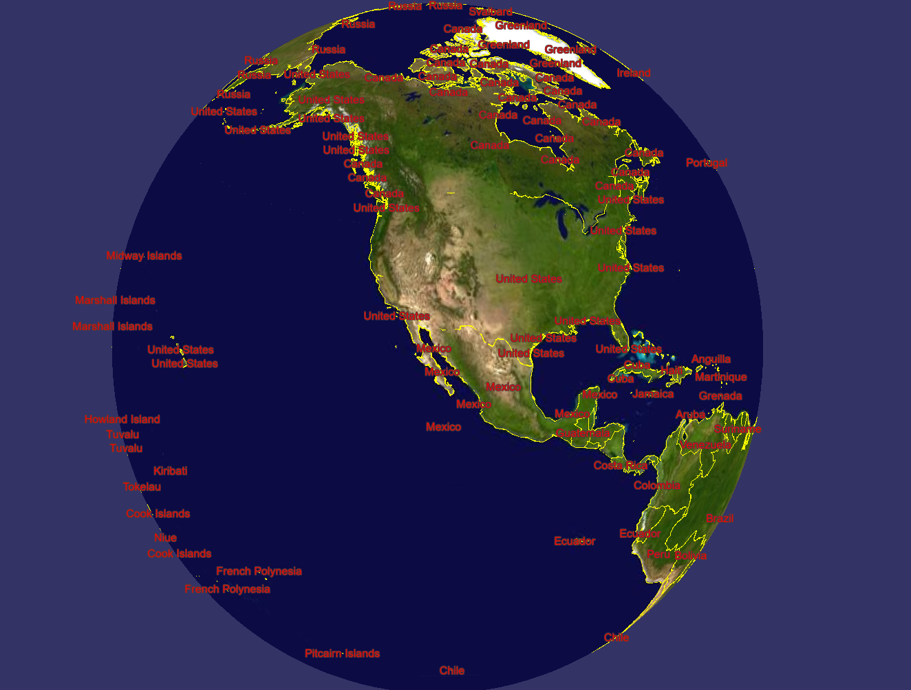
开启"--labels" 标注的图元信息,这些是读取shp中的字段加载的!
        Ring* line = new Ring();

        line->push_back(osg::Vec3d(-, , ));

        line->push_back(osg::Vec3d(-, , ));

        line->push_back(osg::Vec3d(-, , ));

        line->push_back(osg::Vec3d(-, , ));

        ogrData.geometry() = line;
开启"--mem"代码绘制
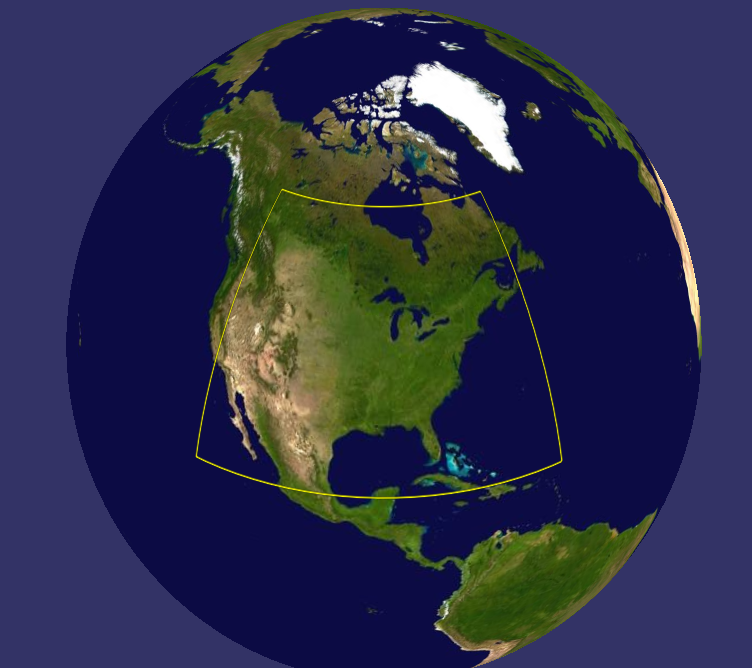
开启"--mem"代码绘制
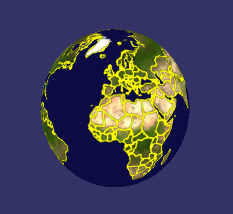
开启栅格化"--rasterize"
[原][OE][官方例子]osgearth_features OE地球添加shp文件(特征标识)的更多相关文章
- [原][OE][官方例子]osgearth_annotation OE地球添加热点标签
OE所有官方例子 OE代码样例 /* -*-c++-*- */ /* osgEarth - Dynamic map generation toolkit for OpenSceneGraph * Co ...
- Asp.Net MVC4.0 官方教程 入门指南之三--添加一个视图
Asp.Net MVC4.0 官方教程 入门指南之三--添加一个视图 在本节中,您需要修改HelloWorldController类,从而使用视图模板文件,干净优雅的封装生成返回到客户端浏览器HTML ...
- Java Restful框架:Jersey入门示例(官方例子)
本文主要介绍了Java Restful框架Jersey入门例子(来源于官方网站https://jersey.java.net/),废话不多说进入正题. 在Jersey官方示例中(https://jer ...
- Asp.Net MVC4.0 官方教程 入门指南之四--添加一个模型
Asp.Net MVC4.0 官方教程 入门指南之四--添加一个模型 在这一节中,你将添加用于管理数据库中电影的类.这些类是ASP.NET MVC应用程序的模型部分. 你将使用.NET Framewo ...
- ArcGIS Earth(原谷歌地球)如何获取高精度矢量地图数据?(shp文件/要素类/kml)
大家好,这次来分享干货.做地理分析的同学,或者需要使用地图却不知道哪里有矢量数据的时候,怎么办呢? 这次,我就告诉大家哪里能自己手工制作矢量点线面数据!注意哦,是自己绘制的. 使用到的软件: ArcG ...
- 解析苹果的官方例子LazyTableImages实现图片懒加载原理
解析苹果的官方例子LazyTableImages实现图片懒加载原理 首先在官网下载源码: https://developer.apple.com/library/ios/navigation/#sec ...
- 向Maven的本地库中添加jar文件
有时我们要用的 maven 依赖项在官方repo库中找不到,然而我们从其他渠道获得了依赖项中的所有jar文件,本文记录了如何向本地库添加jar文件. 从复杂到简单,有三种方法: 使用 maven 的仓 ...
- 关于在工程中添加新文件时的LNK2019错误的一个解决办法
我这几天一直在研究Qt的串口程序,在读懂了官方给出的实例程序后我决定把其多线程的串口监视程序加入到我自己的工程中,便直接把问价复制到自己的工程下面,在Qt中加入到自己的工程中,但是总是出现LNK201 ...
- Android 使用版本控制工具时添加忽略文件方式
一.使用SVN管理项目时,添加忽略文件的方式 Android Studio 配合SVN时,添加忽略文件相对简单,首先打开项目的Settings选项,切换到Version Control下的Ignore ...
随机推荐
- Lombok的使用详解(最详尽的解释,覆盖讲解所有可用注解),解决@Builder.Default默认值问题
原文:https://blog.csdn.net/f641385712/article/details/82081900 前言 Lombok是一款Java开发插件,使得Java开发者可以通过其定义的一 ...
- visual studio故障修复
如果没有安装程序,直接在控制面板——>程序和功能,在列表中找到您安装的vs,右键选择更改,然后程序会启动,做一些准备.然后又三个选项,可以选择修复.
- littlefs了解一下
littlefs是一个文件系统,断电数据不会出异常,适合IOT场景.
- JDK5不定参数方法
jdk5之后出现了调用方法时传递不定参数的情况,如下所示: List<Intrger> list1 = Arrays.asList(new Integer[]{1,2,3}); List& ...
- 使用dos创建一个maven项目
创建一个maven项目既可以使用eclipse创建,也可以使用dos命令,此文介绍使用dos界面创建一个maven项目 1.win+R输入cmd,打开dos界面 2.cd到你想创建项目的目录(默认都是 ...
- 接口中的JSON报文
原始报文: 请求报文: [ { "appNo" : "", "applicantCredentialCode" : "" ...
- Android平台5+ API提前生效,支持在plusready事件前调用
ios上plus是一直存在的,不涉及等ready事件.但安卓上还是需要等plus ready.在安卓环境中,通常情况下需要html页面解析完成后才会让5+ API生效,安卓的执行的顺序为: 加载htm ...
- mysql在group by分组后查询第二条/第三条乃至每组中任意一条数据
昨天老板让我查询项目中(众筹),没人刚发起感召后,前三笔钱的入账时间和金额,这把大哥整懵逼了,group by在某些方面是好使,但这次不能为我所用了,获取第一笔进账是简单,可以用group by 直接 ...
- Deepgreen & Greenplum DBA小白普及课之三
Deepgreen & Greenplum DBA小白普及课之三(备份问题解答) 不积跬步无以至千里,要想成为一名合格的数据库管理员,首先应该具备扎实的基础知识及问题处理能力.本文参考Pivo ...
- noi.ac #37 dp计数
#include<algorithm> #include<cstring> #include<cstdio> #include<iostream> ty ...