C# UTM坐标和WGS84坐标转换小工具
工具根据:http://home.hiwaay.net/~taylorc/toolbox/geography/geoutm.html js代码改编
工具源码github:https://github.com/JeroLong/TUMAndWGS84TransTool.git
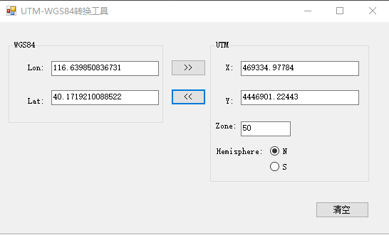
效果:
主要代码:
using System;

using System.Collections.Generic;

using System.Linq;

using System.Text;

namespace UTMAndWGS84TransTool

{

    public class UTMAndWGS84

    {

        static double pi = Math.PI;

        /* Ellipsoid model constants (actual values here are for WGS84) */

        static double sm_a = 6378137.0;

        static double sm_b = 6356752.314;

        static double sm_EccSquared = 6.69437999013e-03;

        static double UTMScaleFactor = 0.9996;

        /*

        * DegToRad

        *

        * Converts degrees to radians.

        *

        */

        private static double DegToRad(double deg)

        {

            return (deg / 180.0 * pi);

        }

        /*

        * RadToDeg

        *

        * Converts radians to degrees.

        *

        */

        private static double RadToDeg(double rad)

        {

            return (rad / pi * 180.0);

        }

        /*

        * ArcLengthOfMeridian

        *

        * Computes the ellipsoidal distance from the equator to a point at a

        * given latitude.

        *

        * Reference: Hoffmann-Wellenhof, B., Lichtenegger, H., and Collins, J.,

        * GPS: Theory and Practice, 3rd ed.  New York: Springer-Verlag Wien, 1994.

        *

        * Inputs:

        *     phi - Latitude of the point, in radians.

        *

        * Globals:

        *     sm_a - Ellipsoid model major axis.

        *     sm_b - Ellipsoid model minor axis.

        *

        * Returns:

        *     The ellipsoidal distance of the point from the equator, in meters.

        *

        */

        private static double ArcLengthOfMeridian(double phi)

        {

            double alpha, beta, gamma, delta, epsilon, n;

            double result;

            /* Precalculate n */

            n = (sm_a - sm_b) / (sm_a + sm_b);

            /* Precalculate alpha */

            alpha = ((sm_a + sm_b) / 2.0)

               * (1.0 + (Math.Pow(n, 2.0) / 4.0) + (Math.Pow(n, 4.0) / 64.0));

            /* Precalculate beta */

            beta = (-3.0 * n / 2.0) + (9.0 * Math.Pow(n, 3.0) / 16.0)

               + (-3.0 * Math.Pow(n, 5.0) / 32.0);

            /* Precalculate gamma */

            gamma = (15.0 * Math.Pow(n, 2.0) / 16.0)

                + (-15.0 * Math.Pow(n, 4.0) / 32.0);

            /* Precalculate delta */

            delta = (-35.0 * Math.Pow(n, 3.0) / 48.0)

                + (105.0 * Math.Pow(n, 5.0) / 256.0);

            /* Precalculate epsilon */

            epsilon = (315.0 * Math.Pow(n, 4.0) / 512.0);

            /* Now calculate the sum of the series and return */

            result = alpha

                * (phi + (beta * Math.Sin(2.0 * phi))

                    + (gamma * Math.Sin(4.0 * phi))

                    + (delta * Math.Sin(6.0 * phi))

                    + (epsilon * Math.Sin(8.0 * phi)));

            return result;

        }

        /*

        * UTMCentralMeridian

        *

        * Determines the central meridian for the given UTM zone.

        *

        * Inputs:

        *     zone - An integer value designating the UTM zone, range [1,60].

        *

        * Returns:

        *   The central meridian for the given UTM zone, in radians, or zero

        *   if the UTM zone parameter is outside the range [1,60].

        *   Range of the central meridian is the radian equivalent of [-177,+177].

        *

        */

        private static double UTMCentralMeridian(double zone)

        {

            double cmeridian;

            cmeridian = DegToRad(-183.0 + (zone * 6.0));

            return cmeridian;

        }

        /*

        * FootpointLatitude

        *

        * Computes the footpoint latitude for use in converting transverse

        * Mercator coordinates to ellipsoidal coordinates.

        *

        * Reference: Hoffmann-Wellenhof, B., Lichtenegger, H., and Collins, J.,

        *   GPS: Theory and Practice, 3rd ed.  New York: Springer-Verlag Wien, 1994.

        *

        * Inputs:

        *   y - The UTM northing coordinate, in meters.

        *

        * Returns:

        *   The footpoint latitude, in radians.

        *

        */

        private static double FootpointLatitude(double y)

        {

            double y_, alpha_, beta_, gamma_, delta_, epsilon_, n;

            double result;

            /* Precalculate n (Eq. 10.18) */

            n = (sm_a - sm_b) / (sm_a + sm_b);

            /* Precalculate alpha_ (Eq. 10.22) */

            /* (Same as alpha in Eq. 10.17) */

            alpha_ = ((sm_a + sm_b) / 2.0)

                * ( + (Math.Pow(n, 2.0) / ) + (Math.Pow(n, 4.0) / ));

            /* Precalculate y_ (Eq. 10.23) */

            y_ = y / alpha_;

            /* Precalculate beta_ (Eq. 10.22) */

            beta_ = (3.0 * n / 2.0) + (-27.0 * Math.Pow(n, 3.0) / 32.0)

                + (269.0 * Math.Pow(n, 5.0) / 512.0);

            /* Precalculate gamma_ (Eq. 10.22) */

            gamma_ = (21.0 * Math.Pow(n, 2.0) / 16.0)

                + (-55.0 * Math.Pow(n, 4.0) / 32.0);

            /* Precalculate delta_ (Eq. 10.22) */

            delta_ = (151.0 * Math.Pow(n, 3.0) / 96.0)

                + (-417.0 * Math.Pow(n, 5.0) / 128.0);

            /* Precalculate epsilon_ (Eq. 10.22) */

            epsilon_ = (1097.0 * Math.Pow(n, 4.0) / 512.0);

            /* Now calculate the sum of the series (Eq. 10.21) */

            result = y_ + (beta_ * Math.Sin(2.0 * y_))

                + (gamma_ * Math.Sin(4.0 * y_))

                + (delta_ * Math.Sin(6.0 * y_))

                + (epsilon_ * Math.Sin(8.0 * y_));

            return result;

        }

        /*

        * MapLatLonToXY

        *

        * Converts a latitude/longitude pair to x and y coordinates in the

        * Transverse Mercator projection.  Note that Transverse Mercator is not

        * the same as UTM; a scale factor is required to convert between them.

        *

        * Reference: Hoffmann-Wellenhof, B., Lichtenegger, H., and Collins, J.,

        * GPS: Theory and Practice, 3rd ed.  New York: Springer-Verlag Wien, 1994.

        *

        * Inputs:

        *    phi - Latitude of the point, in radians.

        *    lambda - Longitude of the point, in radians.

        *    lambda0 - Longitude of the central meridian to be used, in radians.

        *

        * Outputs:

        *    xy - A 2-element array containing the x and y coordinates

        *         of the computed point.

        *

        * Returns:

        *    The function does not return a value.

        *

        */

        private static void MapLatLonToXY(double phi, double lambda, double lambda0, out double[] xy)

        {

            double N, nu2, ep2, t, t2, l;

            double l3coef, l4coef, l5coef, l6coef, l7coef, l8coef;

            double tmp;

            /* Precalculate ep2 */

            ep2 = (Math.Pow(sm_a, 2.0) - Math.Pow(sm_b, 2.0)) / Math.Pow(sm_b, 2.0);

            /* Precalculate nu2 */

            nu2 = ep2 * Math.Pow(Math.Cos(phi), 2.0);

            /* Precalculate N */

            N = Math.Pow(sm_a, 2.0) / (sm_b * Math.Sqrt( + nu2));

            /* Precalculate t */

            t = Math.Tan(phi);

            t2 = t * t;

            tmp = (t2 * t2 * t2) - Math.Pow(t, 6.0);

            /* Precalculate l */

            l = lambda - lambda0;

            /* Precalculate coefficients for l**n in the equations below

               so a normal human being can read the expressions for easting

               and northing

               -- l**1 and l**2 have coefficients of 1.0 */

            l3coef = 1.0 - t2 + nu2;

            l4coef = 5.0 - t2 +  * nu2 + 4.0 * (nu2 * nu2);

            l5coef = 5.0 - 18.0 * t2 + (t2 * t2) + 14.0 * nu2

                - 58.0 * t2 * nu2;

            l6coef = 61.0 - 58.0 * t2 + (t2 * t2) + 270.0 * nu2

                - 330.0 * t2 * nu2;

            l7coef = 61.0 - 479.0 * t2 + 179.0 * (t2 * t2) - (t2 * t2 * t2);

            l8coef = 1385.0 - 3111.0 * t2 + 543.0 * (t2 * t2) - (t2 * t2 * t2);

            xy = new double[];

            /* Calculate easting (x) */

            xy[] = N * Math.Cos(phi) * l

                + (N / 6.0 * Math.Pow(Math.Cos(phi), 3.0) * l3coef * Math.Pow(l, 3.0))

                + (N / 120.0 * Math.Pow(Math.Cos(phi), 5.0) * l5coef * Math.Pow(l, 5.0))

                + (N / 5040.0 * Math.Pow(Math.Cos(phi), 7.0) * l7coef * Math.Pow(l, 7.0));

            /* Calculate northing (y) */

            xy[] = ArcLengthOfMeridian(phi)

                + (t / 2.0 * N * Math.Pow(Math.Cos(phi), 2.0) * Math.Pow(l, 2.0))

                + (t / 24.0 * N * Math.Pow(Math.Cos(phi), 4.0) * l4coef * Math.Pow(l, 4.0))

                + (t / 720.0 * N * Math.Pow(Math.Cos(phi), 6.0) * l6coef * Math.Pow(l, 6.0))

                + (t / 40320.0 * N * Math.Pow(Math.Cos(phi), 8.0) * l8coef * Math.Pow(l, 8.0));

            return;

        }

        /*

        * MapXYToLatLon

        *

        * Converts x and y coordinates in the Transverse Mercator projection to

        * a latitude/longitude pair.  Note that Transverse Mercator is not

        * the same as UTM; a scale factor is required to convert between them.

        *

        * Reference: Hoffmann-Wellenhof, B., Lichtenegger, H., and Collins, J.,

        *   GPS: Theory and Practice, 3rd ed.  New York: Springer-Verlag Wien, 1994.

        *

        * Inputs:

        *   x - The easting of the point, in meters.

        *   y - The northing of the point, in meters.

        *   lambda0 - Longitude of the central meridian to be used, in radians.

        *

        * Outputs:

        *   philambda - A 2-element containing the latitude and longitude

        *               in radians.

        *

        * Returns:

        *   The function does not return a value.

        *

        * Remarks:

        *   The local variables Nf, nuf2, tf, and tf2 serve the same purpose as

        *   N, nu2, t, and t2 in MapLatLonToXY, but they are computed with respect

        *   to the footpoint latitude phif.

        *

        *   x1frac, x2frac, x2poly, x3poly, etc. are to enhance readability and

        *   to optimize computations.

        *

        */

        private static void MapXYToLatLon(double x, double y, double lambda0, out double[] xy)

        {

            double phif, Nf, Nfpow, nuf2, ep2, tf, tf2, tf4, cf;

            double x1frac, x2frac, x3frac, x4frac, x5frac, x6frac, x7frac, x8frac;

            double x2poly, x3poly, x4poly, x5poly, x6poly, x7poly, x8poly;

            /* Get the value of phif, the footpoint latitude. */

            phif = FootpointLatitude(y);

            /* Precalculate ep2 */

            ep2 = (Math.Pow(sm_a, 2.0) - Math.Pow(sm_b, 2.0))

                  / Math.Pow(sm_b, 2.0);

            /* Precalculate cos (phif) */

            cf = Math.Cos(phif);

            /* Precalculate nuf2 */

            nuf2 = ep2 * Math.Pow(cf, 2.0);

            /* Precalculate Nf and initialize Nfpow */

            Nf = Math.Pow(sm_a, 2.0) / (sm_b * Math.Sqrt( + nuf2));

            Nfpow = Nf;

            /* Precalculate tf */

            tf = Math.Tan(phif);

            tf2 = tf * tf;

            tf4 = tf2 * tf2;

            /* Precalculate fractional coefficients for x**n in the equations

               below to simplify the expressions for latitude and longitude. */

            x1frac = 1.0 / (Nfpow * cf);

            Nfpow *= Nf;   /* now equals Nf**2) */

            x2frac = tf / (2.0 * Nfpow);

            Nfpow *= Nf;   /* now equals Nf**3) */

            x3frac = 1.0 / (6.0 * Nfpow * cf);

            Nfpow *= Nf;   /* now equals Nf**4) */

            x4frac = tf / (24.0 * Nfpow);

            Nfpow *= Nf;   /* now equals Nf**5) */

            x5frac = 1.0 / (120.0 * Nfpow * cf);

            Nfpow *= Nf;   /* now equals Nf**6) */

            x6frac = tf / (720.0 * Nfpow);

            Nfpow *= Nf;   /* now equals Nf**7) */

            x7frac = 1.0 / (5040.0 * Nfpow * cf);

            Nfpow *= Nf;   /* now equals Nf**8) */

            x8frac = tf / (40320.0 * Nfpow);

            /* Precalculate polynomial coefficients for x**n.

               -- x**1 does not have a polynomial coefficient. */

            x2poly = -1.0 - nuf2;

            x3poly = -1.0 -  * tf2 - nuf2;

            x4poly = 5.0 + 3.0 * tf2 + 6.0 * nuf2 - 6.0 * tf2 * nuf2

                - 3.0 * (nuf2 * nuf2) - 9.0 * tf2 * (nuf2 * nuf2);

            x5poly = 5.0 + 28.0 * tf2 + 24.0 * tf4 + 6.0 * nuf2 + 8.0 * tf2 * nuf2;

            x6poly = -61.0 - 90.0 * tf2 - 45.0 * tf4 - 107.0 * nuf2

                + 162.0 * tf2 * nuf2;

            x7poly = -61.0 - 662.0 * tf2 - 1320.0 * tf4 - 720.0 * (tf4 * tf2);

            x8poly = 1385.0 + 3633.0 * tf2 + 4095.0 * tf4 +  * (tf4 * tf2);

            xy = new double[];

            /* Calculate latitude */

            xy[] = phif + x2frac * x2poly * (x * x)

                + x4frac * x4poly * Math.Pow(x, 4.0)

                + x6frac * x6poly * Math.Pow(x, 6.0)

                + x8frac * x8poly * Math.Pow(x, 8.0);

            /* Calculate longitude */

            xy[] = lambda0 + x1frac * x

                + x3frac * x3poly * Math.Pow(x, 3.0)

                + x5frac * x5poly * Math.Pow(x, 5.0)

                + x7frac * x7poly * Math.Pow(x, 7.0);

            return;

        }

        /*

        * LatLonToUTMXY

        *

        * Converts a latitude/longitude pair to x and y coordinates in the

        * Universal Transverse Mercator projection.

        *

        * Inputs:

        *   lat - Latitude of the point, in radians.

        *   lon - Longitude of the point, in radians.

        *   zone - UTM zone to be used for calculating values for x and y.

        *          If zone is less than 1 or greater than 60, the routine

        *          will determine the appropriate zone from the value of lon.

        *

        * Outputs:

        *   xy - A 2-element array where the UTM x and y values will be stored.

        *

        * Returns:

        *   The UTM zone used for calculating the values of x and y.

        *

        */

        public static double[] LatLonToUTMXY(double lat, double lon)

        {

            double zone = Math.Floor((lon + 180.0) / ) + ;

            double[] xy = new double[];

            MapLatLonToXY(DegToRad(lat),DegToRad (lon), UTMCentralMeridian(zone), out xy);

            /* Adjust easting and northing for UTM system. */

            xy[] = xy[] * UTMScaleFactor + 500000.0;

            xy[] = xy[] * UTMScaleFactor;

            if (xy[] < 0.0)

                xy[] = xy[] + 10000000.0;

            return new double[] { xy[], xy[], zone };

        }

        /*

        * UTMXYToLatLon

        *

        * Converts x and y coordinates in the Universal Transverse Mercator

        * projection to a latitude/longitude pair.

        *

        * Inputs:

        *    x - The easting of the point, in meters.

        *    y - The northing of the point, in meters.

        *    zone - The UTM zone in which the point lies.

        *    southhemi - True if the point is in the southern hemisphere;

        *               false otherwise.

        *

        * Outputs:

        *    latlon - A 2-element array containing the latitude and

        *            longitude of the point, in radians.

        *

        * Returns:

        *    The function does not return a value.

        *

        */

        public static double[] UTMXYToLatLon(double x, double y, double zone, bool southhemi)

        {

            double cmeridian;

            x -= 500000.0;

            x /= UTMScaleFactor;

            /* If in southern hemisphere, adjust y accordingly. */

            if (southhemi)

                y -= 10000000.0;

            y /= UTMScaleFactor;

            cmeridian = UTMCentralMeridian(zone);

            double[] xy = new double[];

            MapXYToLatLon(x, y, cmeridian, out xy);

            xy[] = RadToDeg(xy[]);

            xy[] = RadToDeg(xy[]);

            return xy;

        }

    }

}
C# UTM坐标和WGS84坐标转换小工具的更多相关文章
- 火星坐标、百度坐标、WGS84坐标转换代码(JS、python版)
火星坐标.百度坐标.WGS84坐标转换代码(JS.python版) 一.JS版本源码 github:https://github.com/wandergis/coordTransform /** * ...
- 火星坐标、百度坐标、WGS84坐标转换代码(JS)
JS版本源码 /** * Created by Wandergis on 2015/7/8. * 提供了百度坐标(BD09).国测局坐标(火星坐标,GCJ02).和WGS84坐标系之间的转换 */ / ...
- 经纬坐标(BLH)数据创建.kml文件小工具设计 Java版
技术背景 KML,是标记语言(Keyhole Markup Language)的缩写,最初由Keyhole公司开发,是一种基于XML 语法与格式的.用于描述和保存地理信息(如点.线.图像.多边形和模型 ...
- Python趣味实用小工具
代码地址如下:http://www.demodashi.com/demo/12918.html python 趣味实用小工具 概述 用python实现的三个趣味实用小工具: 图片转Execl工具 , ...
- 火星坐标、百度坐标、WGS-84坐标相互转换及墨卡托投影坐标转经纬度JavaScript版
火星坐标 火星坐标是国家测绘局为了国家安全在原始坐标的基础上进行偏移得到的坐标,基本国内的电子地图.导航设备都是采用的这一坐标系或在这一坐标的基础上进行二次加密得到的.火星坐标的真实名称应该是GCJ- ...
- Java生成验证码小工具
无意中看到一个生成简易验证码的小工具类(保存学习): 工具类代码: import java.awt.BasicStroke; import java.awt.Color; import java.aw ...
- OpenCV探索之路(二十五):制作简易的图像标注小工具
搞图像深度学习的童鞋一定碰过图像数据标注的东西,当我们训练网络时需要训练集数据,但在网上又没有找到自己想要的数据集,这时候就考虑自己制作自己的数据集了,这时就需要对图像进行标注.图像标注是件很枯燥又很 ...
- 有哪些你不知道的python小工具
python作为越来越流行的一种编程语言,不仅仅是因为它语言简单,有许多现成的包可以直接调用. python中还有大量的小工具,让你的python工作更有效率. 1.- 快速共享 - HTTP服务器 ...
- BD09坐标(百度坐标) WGS84(GPS坐标) GCJ02(国测局坐标) 的相互转换
BD09坐标(百度坐标) WGS84(GPS坐标) GCJ02(国测局坐标) 的相互转换 http://www.cnphp6.com/archives/24822 by root ⋅ Leave a ...
随机推荐
- 【阿里云IoT+YF3300】7.物联网设备表达式运算
很多时候从设备采集的数据并不能直接使用,还需要进行处理一下.如果采用脚本处理,有点太复杂了,而采用表达式运算,则很方便地解决了此类问题. 一. 设备连接 运行环境搭建:Win7系统请下载相关的设备驱 ...
- JVM(1) Java内存区域
对于Java程序员来说,在虚拟机自动内存管理机制的帮助下,不再需要为每一个new操作去写配对的delete/free代码,不容易出现内存泄漏和内存溢出问题.不过,也正是因为Java程序员把内存控制的权 ...
- Mysql数据库(十)MySQL性能优化
一.优化概述 为了提高MySQL数据库的性能,不要进行一系列的优化措施.如果MySQL数据库需要进行大量的查询操作,那么就需要对查询语句进行优化.对于耗费时间的查询语句进行优化,可以提高整体地查询速度 ...
- Linux之Centos7开机之后连不上网
问题:ns33mtu 1500 qdisc noop state DOWN group default qlen 1000 解决方法: root@topcheer ~]# systemctl stop ...
- 利用span设置文字固定宽度
<input type="radio" name="dispMode" id="rdoManul" value="manul ...
- nginx基于uwsgi部署Django
1.安装nginx yum install -y nginx(需要epel源) 2.安装uwsgi yum groupinstall "Development tools" yum ...
- Python安装pyinstaller方法,以及将项目生成可执行程序的步骤
pyinstaller安装方法 前提:确保计算机安装了Python语言环境,并且正确配置了环境变量. 方法一:联网在线自动安装 选择一 Windows OS下进入cmd(命令行窗口) 输入:pip i ...
- SpringBoot自定义starter及自动配置
SpringBoot的核心就是自动配置,而支持自动配置的是一个个starter项目.除了官方已有的starter,用户自己也可以根据规则自定义自己的starter项目. 自定义starter条件 自动 ...
- MySQL查询-分组取组中某字段最大(小)值所有记录
最近做东西的时候,用到一个数据库的查询.将记录按某个字段分组,取每个分组中某个字段的最大值的所有记录.举栗子来说. 已知分数表“score”,包含字段“id", "name&quo ...
- Function:凸包,单调栈,题意转化,单峰函数三分,离线处理
很难啊啊啊!!! bzoj5380原题,应该可以粘题面. 问题转换: 有一个n列1e9行的矩阵,每一列上都写着相同的数字Ai. 你从位置(x,y)出发每一步可以向左上方或左方走一步,最后走到第一行. ...