Google Maps API 调用实例
本实例介绍如何调用Google Maps API,并实现用鼠标标注地图,保存进数据库,以及二次加载显示等。
1.需要新建一个自定义控件(如:Map.ascx),用于显示Google地图:
<%@ Control Language="C#" AutoEventWireup="true" CodeBehind="Map.ascx.cs" Inherits="StarSoft.UI.Customer.UserControl.Map" %>
<div id="map" style="width: 100%; height: 360px;">
</div>
<table style="display: none">
<tr>
<td width="60px">
<span>
纬度</span>
</td>
<td>
<asp:TextBox ID="txtY" runat="server" CssClass="txtbase" onfocus="this.className='txtfocus';"
onblur="this.className='txtbase';" onpropertychange="javascript:CheckInputFloat(this);"></asp:TextBox>
</td>
<td>
<span>
经度</span>
</td>
<td>
<asp:TextBox ID="txtX" runat="server" CssClass="txtbase" onfocus="this.className='txtfocus';"
onblur="this.className='txtbase';" onpropertychange="javascript:CheckInputFloat(this);"></asp:TextBox>
</td>
</tr>
<tr>
<td colspan="4">
<script src=" http://ditu.google.com/maps?file=api&v=2&sensor=false&key=<%=System.Configuration.ConfigurationSettings.AppSettings["googlemapkey"].Trim() %>"
type="text/javascript"></script>
<script language="javascript" type="text/javascript">
function CheckInputFloat(oInput) {
if ('' != oInput.value.replace(/\d{1,}\.{0,1}\d{0,}/, '')) {
oInput.value = oInput.value.match(/\d{1,}\.{0,1}\d{0,}/) == null ? '' : oInput.value.match(/\d{1,}\.{0,1}\d{0,}/);
}
} //<![CDATA[
var x;
var geocoder;
var marker;
if (GBrowserIsCompatible()) {
var map = new GMap2(document.getElementById("map"));
var LatValue = document.getElementById("<%=txtX.ClientID%>").value;
var LngValue = document.getElementById("<%=txtY.ClientID%>").value;
if ((LatValue == "") || (LngValue == "")) {
map.setCenter(new GLatLng(30.25372, 120.13343), 13);
}
else {
map.setCenter(new GLatLng(LatValue, LngValue), 13);
var curpoint = new GLatLng(LatValue, LngValue);
marker = new GMarker(curpoint, this.ico);
map.addOverlay(marker);
}
geocoder = new GClientGeocoder();
}
function createMarker(point, title, html) {
var marker = new GMarker(point);
//GEvent.addListener(marker, "click", function(){marker.openInfoWindowHtml(html,{maxContent: html,maxTitle: title});});
return marker;
}
function showAddress(address) {
if (geocoder) {
geocoder.getLatLng(
'中国' + address,
function (point) {
if (!point) {
// alert(address + " 未找到");
}
else {
if (marker)//移除上一個點
{
map.removeOverlay(marker);
}
map.setCenter(point, 13);
var title = "地址";
marker = createMarker(point, title, address);
map.addOverlay(marker);
//marker.openInfoWindowHtml(address,{ maxContent: address, maxTitle: title});
}
}
);
}
}
GEvent.addListener(map, 'click', function (overlay, point) {
if (point) {
map.clearOverlays();
var marker = new GMarker(point, { draggable: true });
map.addOverlay(marker); GEvent.addListener(marker, "dragstart", function () {
});
GEvent.addListener(marker, "dragend", function () {
point = marker.getLatLng();
document.getElementById("<%=txtY.ClientID%>").value = point.x;
document.getElementById("<%=txtX.ClientID%>").value = point.y;
});
document.getElementById("<%=txtY.ClientID%>").value = point.x;
document.getElementById("<%=txtX.ClientID%>").value = point.y;
}
});
map.enableScrollWheelZoom();
map.addControl(new GSmallZoomControl());
map.addControl(new GMapTypeControl()); //]]>
</script>
</td>
</tr>
</table>
Map.ascx
using System;

using System.Collections;

using System.Configuration;

using System.Data;

using System.Linq;

using System.Web;

using System.Web.Security;

using System.Web.UI;

using System.Web.UI.HtmlControls;

using System.Web.UI.WebControls;

using System.Web.UI.WebControls.WebParts;

using System.Xml.Linq;

namespace StarSoft.UI.Customer.UserControl

{

    public partial class Map : System.Web.UI.UserControl

    {

        /// <summary>

        /// 纬度

        /// </summary>

        public string Latitude

        {

            get { return this.txtX.Text; }

            set { this.txtX.Text = value; }

        }

        /// <summary>

        /// 经度

        /// </summary>

        public string Longitude

        {

            get { return this.txtY.Text; }

            set { this.txtY.Text = value; }

        }

        protected void Page_Load(object sender, EventArgs e)

        {

        }

    }

}
Map.ascx.cs
2.页面中调用这个自定义控件:
<%@ Page Language="C#" AutoEventWireup="true" CodeBehind="AreaLocation.aspx.cs" Inherits="StarSoft.UI.Customer.AreaLocation" %>

<%@ Register src="UserControl/Map.ascx" tagname="Map" tagprefix="uc1" %>

<!DOCTYPE html PUBLIC "-//W3C//DTD XHTML 1.0 Transitional//EN" "http://www.w3.org/TR/xhtml1/DTD/xhtml1-transitional.dtd">

<html xmlns="http://www.w3.org/1999/xhtml" >

<head runat="server">

    <title>无标题页</title>

   <webcontrol:Style ID="Style" runat="server" />

   <script language="javascript" type="text/javascript">

      function ChooseLoaction()

      {

         var txtX=document.getElementById('<%=Map1.FindControl("txtX").ClientID %>').value;

         var txtY= document.getElementById('<%=Map1.FindControl("txtY").ClientID %>').value;

         if(txtX=="")

         {

             alert('请选择经纬度!');

         }

         else

         {

            window.returnVal =  txtX+"|"+ txtY;

            window.parent.hidePopWin(true);

         }

      }

   </script>

</head>

<body>

    <form id="form1" runat="server">

   <div class="popForm" >

            <div class="mainForm">

        <uc1:Map ID="Map1" runat="server" />

    </div></div>

    <div class="operArea">

                <div class="btnArea" >

        <input type="button"  id="BtnQuery" class="btnSubmit"   runat="server"  onclick="javascript:ChooseLoaction();"/>

        <input type="button"  id="close" class="btnReturn"  onclick="javascript:parent.hidePopWin(false);" runat="server"/>

                </div>

            </div>

    </form>

</body>

</html>
AreaLocation。aspx
using System;

using System.Collections;

using System.Configuration;

using System.Data;

using System.Linq;

using System.Web;

using System.Web.Security;

using System.Web.UI;

using System.Web.UI.HtmlControls;

using System.Web.UI.WebControls;

using System.Web.UI.WebControls.WebParts;

using System.Xml.Linq;

namespace StarSoft.UI.Customer

{

    public partial class AreaLocation : System.Web.UI.Page

    {

        protected void Page_Load(object sender, EventArgs e)

        {

            if (!string.IsNullOrEmpty(StrLoactID) && StrLoactID != "null")

            {

                Map1.Latitude = StrLoactID.Split(',')[];

                Map1.Longitude = StrLoactID.Split(',')[];

            }

            if (!IsPostBack)

            {

                BtnQuery.Value = StarSoft.Common.ResourceManager.Field("Query");

                close.Value = StarSoft.Common.ResourceManager.Field("CancelBtn");

                if (Ty != "")

                {

                    close.Value = StarSoft.Common.ResourceManager.Field("CloseBtn");

                    BtnQuery.Style["display"] = "none";

                }

            }

        }

        /// <summary>

        /// 经纬度信息

        /// </summary>

        public string StrLoactID

        {

            get

            {

                try

                {

                    return Request.Params["LoactID"].ToString();

                }

                catch

                {

                    return "";

                }

            }

        }

        /// <summary>

        /// 经纬度信息

        /// </summary>

        public string Ty

        {

            get

            {

                try

                {

                    return Request.Params["Ty"].ToString();

                }

                catch

                {

                    return "";

                }

            }

        }

    }

}
AreaLocation。aspx.cs
3.web.config文件中配置Google Map访问秘钥:
<add key="googlemapkey" value="ABQIAAAAFLEnBlXXNVEsCX6NrllENxRtJCFYwXExx0HqCDFUHyWjOHbgXhTNZ_AeqPjv3EmRwdeButm3wRXAuw"/>
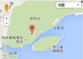
运行效果图:
Google Maps API 调用实例的更多相关文章
- Google maps API开发(二)(转)
这一篇主要实现怎么调用Google maps API中的地址解析核心类GClientGeocoder: 主要功能包括地址解析.反向解析.本地搜索.周边搜索等, 我这里主要有两个实例: 实例一.当你搜索 ...
- Google Maps API Web Services
原文:Google Maps API Web Services 摘自:https://developers.google.com/maps/documentation/webservices/ Goo ...
- Google maps API开发
原文:Google maps API开发 Google maps API开发(一) 最近做一个小东西用到google map,突击了一下,收获不小,把自己学习的一些小例子记录下来吧 一.加载Googl ...
- Google Maps API V3 之绘图库 信息窗口
Google官方教程: Google 地图 API V3 使用入门 Google 地图 API V3 针对移动设备进行开发 Google 地图 API V3 之事件 Google 地图 API V3 ...
- Google Maps API V3 之 图层
Google官方教程: Google 地图 API V3 使用入门 Google 地图 API V3 针对移动设备进行开发 Google 地图 API V3 之事件 Google 地图 API V3 ...
- Google Maps API V3 之 路线服务
Google官方教程: Google 地图 API V3 使用入门 Google 地图 API V3 针对移动设备进行开发 Google 地图 API V3 之事件 Google 地图 API V3 ...
- Google maps API开发(一)(转)
一.加载Google maps API <script type="text/javascript" src="http://ditu.google.com/map ...
- Google Maps API的使用
之前在学习了简单的API调用后,查看了几个知名网站的API调用方法,发现Google的API调用还是相对比较简单的.下面就从API key的获取.googlemaps的安装,再到实际使用做一下说明. ...
- Android Google Maps API 网络服务用于网络定位、计算路线、获取经纬度、获取详细地址等
extends:http://blog.csdn.net/h7870181/article/details/12505883 Google Maps API 网络服务 官网地址 : https://d ...
- google maps api申请的问题
现在已经改由统一的GOOGLE API控制台进行所有GOOGLE API的管理了. 方法是使用Google帐号登入 https://code.google.com/apis/console. 然后在所 ...
随机推荐
- Unity 打包后文件系统访问的一个小细节
Android: 使用 File 类 来访文本文件系统不区分大小写:但是访问 jar 包内的文件是区分大小写的,比如使用 www类,都需要区分大小写. iOS: 使用 File 类 来访文本文件系统严 ...
- SSAS数据挖掘算法简介
决策树分析算法:以二叉树的形式展现,分析出影响某种行为(如购买自行车)的因素,并对这些因素排序. 聚类分析算法:物以类聚,人以群分.分析特定群体所共同含有的属性(因素). 未完,待续..
- jsf服务器端验证用户输入
服务器端验证用户输入数据步骤 1 html页面上插入要输入数据控件 <h:inputText size="10" value="#{commodityBean.fo ...
- static与线程安全 -摘自网络
在.Net中,Static会经常和线程的东西扯在一起.写的代码是不是线程安全呢?好多程序员都在想,不过,有时候随便就放过了.真正出问题的时候再想.其实,如果程序员一开始就明白这里面的机制,也许,编写的 ...
- Open Dynamics Engine for Linux 安装笔记
下载 在Bitbucket上可以下载到最新的版本(截止目前为0.14版) 或者直接用wget下载 wget "https://bitbucket.org/odedevs/ode/downlo ...
- MSSQLSERVER数据库- 上移和下移的存储过程
做一下备忘 MOVEUP: set ANSI_NULLS ON set QUOTED_IDENTIFIER ON go ALTER PROCEDURE [dbo].[Proc_MoveUp] @id ...
- salt-minion安装脚本
#!/bin/bash cd /usr/local/src/ wget http://mirrors.sohu.com/fedora-epel/6/x86_64/epel-release-6-8.no ...
- SVN高速新手教程
因为做Zip和Rar解析的时候,找到了mucommander工具,可将其jar包导入项目里执行发现报:类型转换错误,org.apache.commons.logging.impl.Log4JLogge ...
- Tinder 心动效果---卡片式view左右滑动
http://www.eoeandroid.com/thread-549316-1-1.html SlideCard.zip
- C# - 系统类 - Object类
Object类 ns:System 此类是所有.NET Framework中的类的基类 Type类就派生自Object类 C#提供了object关键字来表示一个类实例的类型 而无需使用Object作为 ...